A Flickr Group pool is filled by photos of people who add content regularly. These are excellent source of new photos from a smaller community you trust. Justified Image Grid can pull photos from a public Flickr Group pool. Once somebody posts new content into the group, the gallery on your site updates itself automatically. It's great to show the latest content from a given group. Create an invite-only Flickr group to allow trusted people to add photos to your site. Create contest using this setup, or aggregate photos from an event by encouraging people to upload their photos to your Flickr Group pool - and show those on your site.
Displaying the Flickr Group pool: "Beaches of the World (geotagged)"
Check out this group on Flickr too!
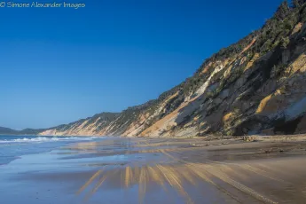
Rainbow Beach
A wider shot of the beach and the coloured sands. As well as the wet sand reflections, you can see the tyer marks in the sand from the 4WDs that are allowed to drive along the beach.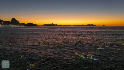
Nascer do Sol em Copacabana
Copacabana - Rio de Janeiro - Brasil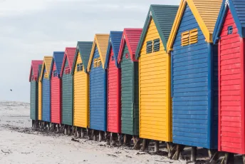
Muizenberg Beach Huts
Muizenberg - South Africa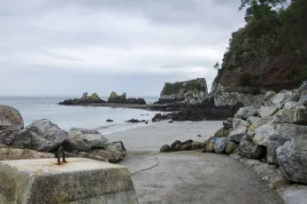
Plage du Kador
52633284821_6da3ba9199_k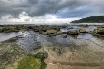
Bateau Bay Beach
standing on the beach watching the storm coming and hoping you don't get your camera wet
Let there be light
7886569882_bfee06b67c_o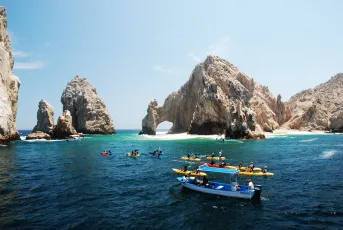
boat tour of Los Arcos and Lover’s Beach (Playa del Amor), Cabo San Lucas, Baja California, Mexico
3986058257_335de5b004_k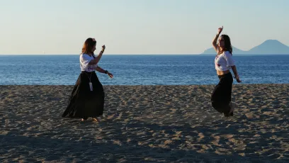
Dancing in the sunset
At the beach of Brolo, Sicily before the sun comes down
Green Light House
Ferragudo, Portugal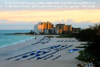
St. Pete Beach, FL
For we did not follow cleverly devised stories when we told you about the coming of our Lord Jesus Christ in power, but we were eyewitnesses of his majesty. He received honor and glory from God the Father when the voice came to him from the Majestic Glory, saying, “This is my Son, whom I love; with him I am well pleased.” We ourselves heard this voice that came from heaven when we were with him on the sacred mountain. We also have the prophetic message as something completely reliable, and you will do well to pay attention to it, as to a light shining in a dark place, until the day dawns and the morning star rises in your hearts. Above all, you must understand that no prophecy of Scripture came about by the prophet’s own interpretation of things. For prophecy never had its origin in the human will, but prophets, though human, spoke from God as they were carried along by the Holy Spirit. [2 Peter 1:16-21 NIV] 5 MORE THINGS YOU SHOULD KNOW: 1. Like it or not, we are ALL sinners: As the Scriptures say, “No one is righteous—not even one. No one is truly wise; no one is seeking God. All have turned away; all have become useless. No one does good, not a single one.” (Romans 3:10-12 NLT) 2. The punishment for sin is death: When Adam sinned, sin entered the world. Adam’s sin brought death, so death spread to everyone, for everyone sinned. (Romans 5:12 NLT) 3. Jesus is our only hope: But God showed his great love for us by sending Christ to die for us while we were still sinners. (Romans 5:8 NLT) For the wages of sin is death, but the free gift of God is eternal life through Christ Jesus our Lord. (Romans 6:23 NLT) 4. SALVATION is by GRACE through FAITH in JESUS: God saved you by his grace when you believed. And you can’t take credit for this; it is a gift from God. Salvation is not a reward for the good things we have done, so none of us can boast about it. For we are God’s masterpiece. He has created us anew in Christ Jesus, so we can do the good things he planned for us long ago. (Ephesians 2:8-10 NLT) 5. Accept Jesus and receive eternal life: If you openly declare that Jesus is Lord and believe in your heart that God raised him from the dead, you will be saved. (Romans 10:9 NLT) But to all who believed him and accepted him, he gave the right to become children of God. (John 1:12 NLT) And this is what God has testified: He has given us eternal life, and this life is in his Son. Whoever has the Son has life; whoever does not have God’s Son does not have life. (1 John 5:11-12 NLT) Read the Bible for yourself. Allow the Lord to speak to you through his Word. YOUR ETERNITY IS AT STAKE!
Rialto Beach Tidepool
55390112110_cdff07d1c9_k
Jacksonville Beach, FL
beachleft
Noosa National Park - Tea Tree Bay
I've taken many photos here, but I never tire of this gorgeous location.
Benalmádena_08026
53218897979_72584ea320_k
Four Mile Beach
Sunrise on Four Mile Beach, Port Douglas
Combe Martin
14th July 2026.
Looking out from the cathedral
The beach As Catedrais, Galicia again. A great natural place on the sea
sunset over tuggerah lake
8171678500_e0de3732ac_o
Beach Read Chonburi Province Thailand Southeast-Asia © Strand Lektüre Südost-Asien ©
Chonburi Province Thailand Southeast-Asia © Südost-Asien © All rights reserved. Image fully copyrighted. No free usage. All my images strictly only available with written royalty agreement. If interested, ask. © Alle Rechte vorbehalten. Keine Gratisverwendung. Alle meine Bilder immer nur mit schriftl. Honorarvereinbg. Ggf. fragen. ©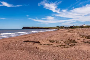
Cap-d'Espoir, Québec, Canada
Like what I do? Please consider faving and/or commenting this photo. Thank you! — 2026.06.08
Plage de l’anse au nord, Percé, Gaspésie, Québec, Canada
Like what I do? Please consider faving and/or commenting this photo. Thank you! — 2026.06.08
seeing the seeweed near the sea
8213875416_4ce95f0432_k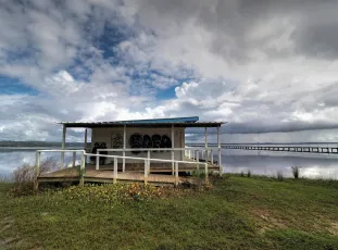
Boat Shed
An abandoned boat shed at Long Jetty, Central Coast, Australia
O'Side Tyson Beach Park Dawn 6Di 8X15mm
SoCal Oceanside Tyson Beach Park Sunrise A Wonderful Part Of Life, Is Sharing Things You Love With People, Like Beautiful Photographic Moments, Every Picture Tells A Story.
15-Meneham (1)
55238889982_b3b96f9a57_b
Low Tide
Nikon AF600 / Kodak Ultramax St Ives, Cornwall, UK- <a href="https://live.staticflickr.com/65535/55409045176_3188315aee_k.jpg" title="Promenade des Anglais 17/06/2025 14h15
Beautiful stone art on the beach in Nice along the Promenades des Anglais.
At the level of the Palais de l’Agriculture.
Promenade des Anglais
The Promenade des Anglais (literally: Walkway of the English) is a promenade along the Mediterranean at Nice, France. It extends from the airport on the west to the Quai des États-Unis (United States Quay) on the east, a distance of approximately 7 km. Administratively speaking, it forms part of Route nationale 98, which runs between Toulon and Menton.
Starting in the second half of the 18th century, the English aristocracy took to spending the winter in Nice, enjoying the panorama along the coast. In 1820, when a particularly harsh winter further north brought an influx of beggars to Nice, some of the English proposed that they could work on the construction of a walkway (chemin de promenade) along the sea. It was funded by the Reverend Lewis Way and members of Holy Trinity Anglican Church. The city of Nice, intrigued by the prospect of a pleasant promenade, greatly increased the scope of the work. The Promenade was first called the Camin deis Anglés (the English Way) by the Niçois in their native dialect. After the annexation of Nice by France in 1860 it was rechristened La Promenade des Anglais.
For the local inhabitants, the Promenade des Anglais has simply become the Promenade or, for short, La Prom. It is popular with bicyclists, baby strollers, and families, especially on Sundays. It has also become a favorite place for skateboarders and in-line skaters.
On 14 July 2016, a truck was deliberately driven at revellers celebrating Bastille Day on the Promenade. The driver, 31-year-old Mohamed Lahouaiej-Bouhlel, also shot at others before crossing the road in the vehicle to continue the assault. The vehicle was surrounded by police near the Palais de la Méditerranée, and Bouhlel was shot dead. 84 were killed, and over 200 wounded. Two people later died, bringing the number of deaths up to 86.
[ Wikipedia ]">
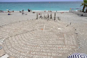
Promenade des Anglais - Nice (France)
Promenade des Anglais 17/06/2025 14h15 Beautiful stone art on the beach in Nice along the Promenades des Anglais. At the level of the Palais de l’Agriculture. Promenade des Anglais The Promenade des Anglais (literally: Walkway of the English) is a promenade along the Mediterranean at Nice, France. It extends from the airport on the west to the Quai des États-Unis (United States Quay) on the east, a distance of approximately 7 km. Administratively speaking, it forms part of Route nationale 98, which runs between Toulon and Menton. Starting in the second half of the 18th century, the English aristocracy took to spending the winter in Nice, enjoying the panorama along the coast. In 1820, when a particularly harsh winter further north brought an influx of beggars to Nice, some of the English proposed that they could work on the construction of a walkway (chemin de promenade) along the sea. It was funded by the Reverend Lewis Way and members of Holy Trinity Anglican Church. The city of Nice, intrigued by the prospect of a pleasant promenade, greatly increased the scope of the work. The Promenade was first called the Camin deis Anglés (the English Way) by the Niçois in their native dialect. After the annexation of Nice by France in 1860 it was rechristened La Promenade des Anglais. For the local inhabitants, the Promenade des Anglais has simply become the Promenade or, for short, La Prom. It is popular with bicyclists, baby strollers, and families, especially on Sundays. It has also become a favorite place for skateboarders and in-line skaters. On 14 July 2016, a truck was deliberately driven at revellers celebrating Bastille Day on the Promenade. The driver, 31-year-old Mohamed Lahouaiej-Bouhlel, also shot at others before crossing the road in the vehicle to continue the assault. The vehicle was surrounded by police near the Palais de la Méditerranée, and Bouhlel was shot dead. 84 were killed, and over 200 wounded. Two people later died, bringing the number of deaths up to 86. [ Wikipedia ] 
Ontario Beach
Lake / Early Summer / Afternoon / Sunny / Rochester / Walk
Morning fog
- North Light, Block Island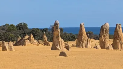
Pinnacles, Nambung National Park, Cervantes, WA, Australia
Buried by a calcerous sand blow, a mature tuart forest eventually decayed, the trunks being replaced by hard calcrete. The slow accumulation of the waterborn seepage of calcrete is revealed by the thin horizontal bedding seen in the sides of these pinnacles. Subsequently the sand blow has moved on, the deflation revealing the moulded pinnacles which replace the trunks of the big tuart trees which formerly grew here. Tuarts grow to over 40m and basal dimensions can be 10m gbh. They were commercially logged and timber exported, in the 19th century, but the wood is very hard and blunts axes (and chainsaws!) readily. Tuarts are Eucalyptus gomphocephala. The large pinnacles retain the size of the large bases of the trunks of these trees which are native to Western Australia and still grow in the region. Large sand blows are still active along this coast of Australia also.
Rainbow Beach
Wet sand reflections in late afternoon light.
majenta skies and green rocks
8166468352_5cb02efe64_o
Setting Sun
nothing like a setting sun to give you that setting sun type feeling
A dear friend.
50657249512_4e7a48d46f_k
Pattaya Between Sea and Sky
55407427282_44787aceb0_b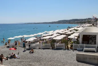
Nice - Nizza: Beachclub Le Temps d‘un Été
55405495872_da5b7205ba_o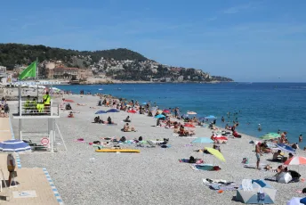
Nice - Nizza: Strand
55405495962_b80f736ddf_o
Clouds and the Pacific throught the Trees. Rialto Beach
55398691768_24febe9db4_k
Beach
City Beach, Aberdeen (July 2026)
Beach
Balmedie Beach, Aberdeen (July 2026)
Beach
Balmedie Beach, Aberdeen (July 2026)
Plage St Antoine
55406057567_c4920096c6_b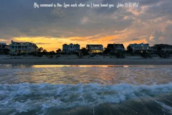
Isle of Palms, SC
“As the Father has loved me, so have I loved you. Now remain in my love. If you keep my commands, you will remain in my love, just as I have kept my Father’s commands and remain in his love. I have told you this so that my joy may be in you and that your joy may be complete. My command is this: Love each other as I have loved you. Greater love has no one than this: to lay down one’s life for one’s friends. You are my friends if you do what I command. I no longer call you servants, because a servant does not know his master’s business. Instead, I have called you friends, for everything that I learned from my Father I have made known to you. You did not choose me, but I chose you and appointed you so that you might go and bear fruit—fruit that will last—and so that whatever you ask in my name the Father will give you. This is my command: Love each other. [John 15:9-17 NIV] 5 MORE THINGS YOU SHOULD KNOW: 1. Like it or not, we are ALL sinners: As the Scriptures say, “No one is righteous—not even one. No one is truly wise; no one is seeking God. All have turned away; all have become useless. No one does good, not a single one.” (Romans 3:10-12 NLT) 2. The punishment for sin is death: When Adam sinned, sin entered the world. Adam’s sin brought death, so death spread to everyone, for everyone sinned. (Romans 5:12 NLT) 3. Jesus is our only hope: But God showed his great love for us by sending Christ to die for us while we were still sinners. (Romans 5:8 NLT) For the wages of sin is death, but the free gift of God is eternal life through Christ Jesus our Lord. (Romans 6:23 NLT) 4. SALVATION is by GRACE through FAITH in JESUS: God saved you by his grace when you believed. And you can’t take credit for this; it is a gift from God. Salvation is not a reward for the good things we have done, so none of us can boast about it. For we are God’s masterpiece. He has created us anew in Christ Jesus, so we can do the good things he planned for us long ago. (Ephesians 2:8-10 NLT) 5. Accept Jesus and receive eternal life: If you openly declare that Jesus is Lord and believe in your heart that God raised him from the dead, you will be saved. (Romans 10:9 NLT) But to all who believed him and accepted him, he gave the right to become children of God. (John 1:12 NLT) And this is what God has testified: He has given us eternal life, and this life is in his Son. Whoever has the Son has life; whoever does not have God’s Son does not have life. (1 John 5:11-12 NLT) Read the Bible for yourself. Allow the Lord to speak to you through his Word. YOUR ETERNITY IS AT STAKE!
Sagi Paradise
55165245568_608f31ba69_k
Torre de vigilancia
Playa Puerta del Mar. Almuñecar.
Plage de "Plougasnou - Saint-Jean-du-Doigt"
55406431121_1bc9824314_k
Up ahead in the distance
There was no shimmering light but that storm came quickly.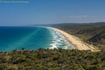
Cooloola Beach
View from Double Island Point looking south. About 60km down the beach is Noosa.
55406257173_fb84ebc740_b
Robinson Cruse Beach Resort - Sipalay, Philippines
55406061866_1f4ae9a295_k- <a href="https://live.staticflickr.com/65535/55405018594_312899a679_k.jpg" title="Port d'Alcúdia
Mallorca / España
See where this picture was taken. [?]
© All Rights Reserved - you may not use this image in any form without my prior permission.">
on the beach
Port d'Alcúdia Mallorca / España See where this picture was taken. [?] © All Rights Reserved - you may not use this image in any form without my prior permission. 
Beach Sea Sky Clouds Sunset Thailand © Strand Meer Himmel Wolken Sonnenuntergang ©
Chonburi Province Thailand Southeast-Asia © Südost-Asien © All rights reserved. Image fully copyrighted. No free usage. All my images strictly only available with written royalty agreement. If interested, ask. © Alle Rechte vorbehalten. Keine Gratisverwendung. Alle meine Bilder immer nur mit schriftl. Honorarvereinbg. Ggf. fragen. ©
Winter Sunrise at the Seaside
Sunrise Seascape with waves at Avalon on the Northern Beaches of Sydney, NSW, Australia.
Winter Sunrise at the Seaside
Sunrise Seascape with waves at Avalon on the Northern Beaches of Sydney, NSW, Australia.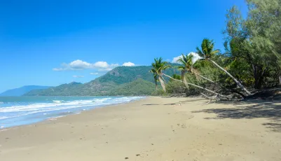
Oak Beach
Beach at the bottom of Thala Resort, near Port Douglas in North Queensland
Carmel Beach
55400976630_bfedaa65d1_k
Carmel Beach
55399640607_1d9efb8042_k
Carmel Beach
55400761504_415f53b98e_k- <a href="https://live.staticflickr.com/65535/55404527910_8818bdbbf6_k.jpg" title=""When the seas of life get rough and you feel like your drowning, remember...your Lifeguard walks on water!"
-- Unknown
Three bracketed photos were taken with a handheld Nikon D7200 and combined with Photomatix Pro to create this HDR image. Additional adjustments were made in Photoshop CS6.
"For I know the plans I have for you", declares the LORD, "plans to prosper you and not to harm you, plans to give you hope and a future." --Jeremiah 29:11
The best way to view my photostream is through Flickriver with the following link: www.flickriver.com/photos/photojourney57/">
Lifeguard Rescue Can - Myrtle Beach, South Carolina
"When the seas of life get rough and you feel like your drowning, remember...your Lifeguard walks on water!" -- Unknown Three bracketed photos were taken with a handheld Nikon D7200 and combined with Photomatix Pro to create this HDR image. Additional adjustments were made in Photoshop CS6. "For I know the plans I have for you", declares the LORD, "plans to prosper you and not to harm you, plans to give you hope and a future." --Jeremiah 29:11 The best way to view my photostream is through Flickriver with the following link: www.flickriver.com/photos/photojourney57/ 
Middle Beach, Avalon, Catalina Island, CA USA - Fong Reunion 2019 4 - DSC07648.tiff
A few clouds can't keep beach-goers away from Middle Beach, Avalon, Catalina Island
Mirandela
Mirandela, Viseu, Portugal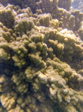
Coral from Above
Shot with an iCatch V Series waterproof camera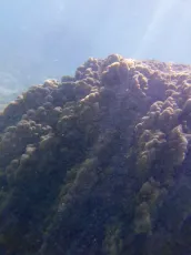
Living Wall
Shot with an iCatch V Series waterproof camera
Contast: Coral vs. Seafloor
Shot with an iCatch V Series waterproof camera
San Sebastián
55402602157_dd94f8f887_k
Le port de Trébeurden
55403915525_4786ca1374_k
Horse-tailed Squirrel Beach Chonburi Province Thailand Southeast-Asia © Strand Pferdeschwanzhörnchen Südost-Asien ©
Chonburi Province Thailand Southeast-Asia © Südost-Asien © All rights reserved. Image fully copyrighted. No free usage. All my images strictly only available with written royalty agreement. If interested, ask. © Alle Rechte vorbehalten. Keine Gratisverwendung. Alle meine Bilder immer nur mit schriftl. Honorarvereinbg. Ggf. fragen. ©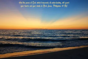
Anna Maria Island, FL
Rejoice in the Lord always. I will say it again: Rejoice! Let your gentleness be evident to all. The Lord is near. Do not be anxious about anything, but in every situation, by prayer and petition, with thanksgiving, present your requests to God. And the peace of God, which transcends all understanding, will guard your hearts and your minds in Christ Jesus. [Philippians 4:4-7 NIV] 5 MORE THINGS YOU SHOULD KNOW: 1. Like it or not, we are ALL sinners: As the Scriptures say, “No one is righteous—not even one. No one is truly wise; no one is seeking God. All have turned away; all have become useless. No one does good, not a single one.” (Romans 3:10-12 NLT) 2. The punishment for sin is death: When Adam sinned, sin entered the world. Adam’s sin brought death, so death spread to everyone, for everyone sinned. (Romans 5:12 NLT) 3. Jesus is our only hope: But God showed his great love for us by sending Christ to die for us while we were still sinners. (Romans 5:8 NLT) For the wages of sin is death, but the free gift of God is eternal life through Christ Jesus our Lord. (Romans 6:23 NLT) 4. SALVATION is by GRACE through FAITH in JESUS: God saved you by his grace when you believed. And you can’t take credit for this; it is a gift from God. Salvation is not a reward for the good things we have done, so none of us can boast about it. For we are God’s masterpiece. He has created us anew in Christ Jesus, so we can do the good things he planned for us long ago. (Ephesians 2:8-10 NLT) 5. Accept Jesus and receive eternal life: If you openly declare that Jesus is Lord and believe in your heart that God raised him from the dead, you will be saved. (Romans 10:9 NLT) But to all who believed him and accepted him, he gave the right to become children of God. (John 1:12 NLT) And this is what God has testified: He has given us eternal life, and this life is in his Son. Whoever has the Son has life; whoever does not have God’s Son does not have life. (1 John 5:11-12 NLT) Read the Bible for yourself. Allow the Lord to speak to you through his Word. YOUR ETERNITY IS AT STAKE!
20250316-7RV03192
Clearwater Beach, Fl.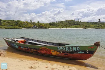
Moreno em Caraíva na Bahia
Caraíva - Bahia - Brasil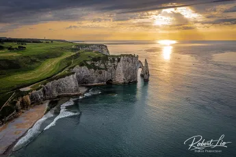
Etretat
France- <a href="https://live.staticflickr.com/65535/55401938699_615df53a8f_k.jpg" title="Today is my wife's birthday and I thought I'd share a photograph of us living our best lives in the Outer Banks of North Carolina last summer...she is the beautiful reason that I am where I am today!! The absolute best thing to ever happen to me and I pray she is happy and has her best birthday ever...
-- Technical Information (or Nerdy Stuff) --
‧ Camera - Nikon D7200 (handheld)
‧ Lens – Nikkor 10-20mm Wide Angle Zoom
‧ ISO – 100
‧ Aperture – f/5
‧ Exposure – 1/320 second
‧ Focal Length – 11.5mm
The original RAW file was processed with Adobe Camera Raw and final adjustments were made with Photoshop CS6.
"For I know the plans I have for you,” declares the LORD, “plans to prosper you and not to harm you, plans to give you hope and a future." --Jeremiah 29:11
The best way to view my photostream is through Flickriver with the following link: www.flickriver.com/photos/photojourney57/">
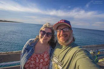
Happy Birthday Sandy - Nags Head Fishing Pier - Outer Banks, North Carolina
Today is my wife's birthday and I thought I'd share a photograph of us living our best lives in the Outer Banks of North Carolina last summer...she is the beautiful reason that I am where I am today!! The absolute best thing to ever happen to me and I pray she is happy and has her best birthday ever... -- Technical Information (or Nerdy Stuff) -- ‧ Camera - Nikon D7200 (handheld) ‧ Lens – Nikkor 10-20mm Wide Angle Zoom ‧ ISO – 100 ‧ Aperture – f/5 ‧ Exposure – 1/320 second ‧ Focal Length – 11.5mm The original RAW file was processed with Adobe Camera Raw and final adjustments were made with Photoshop CS6. "For I know the plans I have for you,” declares the LORD, “plans to prosper you and not to harm you, plans to give you hope and a future." --Jeremiah 29:11 The best way to view my photostream is through Flickriver with the following link: www.flickriver.com/photos/photojourney57/ 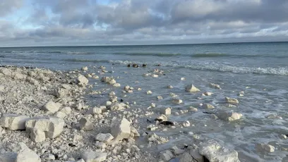
Kridtklinter og sten ved kysten på Møn
Hvide kridtsten på stranden ved Møns Klint i Danmark under en overskyet himmel, med bølger der ruller ind fra Østersøen.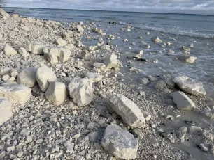
Kridtsten på stranden ved Møns Klint
Store hvide kridtsten ligger spredt på stranden ved Møns Klint i Danmark, hvor bølgerne skyller ind fra Østersøen.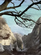
Udsigt gennem trægrene over Østersøen ved Møns Klint
Udsigt over det turkisfarvede vand ved Møns Klint i Danmark, set gennem bladløse trægrene med de hvide kridtklinter i baggrunden.
Stenstrand ved Møns Klint
En stenet strand ved Møns Klint i Danmark, hvor bølgerne skyller ind under en overskyet morgenhimmel med gennembrydende sollys.
South Durras Beach
7806193318_58300186b3_o
BHL1-7 The Mouth of River Naver and Torrisdale Beach, Bettyhill, Sutherland.
View from Bettyhill to Skerray and Torrisdale Bay. To the right in the far distance, is Neave or Coomb Island with its small beach.
BHL1-23 River Naver at Bettyhill
BHL1-14 The Mouth of River Naver and Torrisdale Beach, Bettyhill, Sutherland.
BHL1-14 The Mouth of River Naver and Torrisdale Beach, Bettyhill, Sutherland. In the middle distance is Neave or Coomb Island with its small beach.
Beach Night Thailand © Strand Nacht ©
Chonburi Province Thailand Southeast-Asia © Südost-Asien © All rights reserved. Image fully copyrighted. No free usage. All my images strictly only available with written royalty agreement. If interested, ask. © Alle Rechte vorbehalten. Keine Gratisverwendung. Alle meine Bilder immer nur mit schriftl. Honorarvereinbg. Ggf. fragen. ©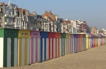
Happy beach huts in Malo-les-Bains
Along the entire seaside promenade of Malo-les-Bains (France), 195 colourful beach huts are set up every year in March. Few People know that the iconic huts, called ‘les kiosques”, have a history dating back to 1886. (Malo-les-Bains is the seaside resort of Dunkirk)
Caraíva na Bahia
Caraíva - Bahia - Brasil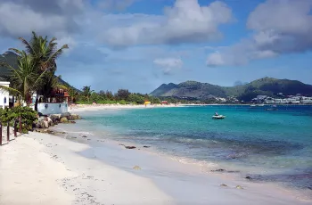
Orient Bay.
St.Martin, French West Indies. ☀️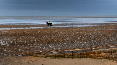
"Hoylake"
I took a walk along this stretch of the beach for the first time. It was the wrong time of the day, but the horse and rider came to my aid.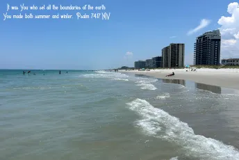
Jacksonville Beach, FL
But God is my King from long ago; he brings salvation on the earth. It was you who split open the sea by your power; you broke the heads of the monster in the waters. It was you who crushed the heads of Leviathan and gave it as food to the creatures of the desert. It was you who opened up springs and streams; you dried up the ever-flowing rivers. The day is yours, and yours also the night; you established the sun and moon. It was you who set all the boundaries of the earth; you made both summer and winter. [Psalm 74:12-17 NIV] 5 MORE THINGS YOU SHOULD KNOW: 1. Like it or not, we are ALL sinners: As the Scriptures say, “No one is righteous—not even one. No one is truly wise; no one is seeking God. All have turned away; all have become useless. No one does good, not a single one.” (Romans 3:10-12 NLT) 2. The punishment for sin is death: When Adam sinned, sin entered the world. Adam’s sin brought death, so death spread to everyone, for everyone sinned. (Romans 5:12 NLT) 3. Jesus is our only hope: But God showed his great love for us by sending Christ to die for us while we were still sinners. (Romans 5:8 NLT) For the wages of sin is death, but the free gift of God is eternal life through Christ Jesus our Lord. (Romans 6:23 NLT) 4. SALVATION is by GRACE through FAITH in JESUS: God saved you by his grace when you believed. And you can’t take credit for this; it is a gift from God. Salvation is not a reward for the good things we have done, so none of us can boast about it. For we are God’s masterpiece. He has created us anew in Christ Jesus, so we can do the good things he planned for us long ago. (Ephesians 2:8-10 NLT) 5. Accept Jesus and receive eternal life: If you openly declare that Jesus is Lord and believe in your heart that God raised him from the dead, you will be saved. (Romans 10:9 NLT) But to all who believed him and accepted him, he gave the right to become children of God. (John 1:12 NLT) And this is what God has testified: He has given us eternal life, and this life is in his Son. Whoever has the Son has life; whoever does not have God’s Son does not have life. (1 John 5:11-12 NLT) Read the Bible for yourself. Allow the Lord to speak to you through his Word. YOUR ETERNITY IS AT STAKE!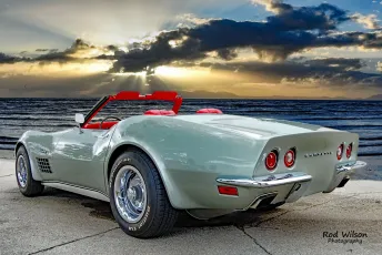
1972 Grey Corvette Roadster Sunset Beach Cruise 1DSii 24mm
SoCal Sunset Oceanside Harbor Cruise A Wonderful Part Of Life, Is Sharing Things You Love With People, Like Beautiful Photographic Moments, Every Picture Tells A Story.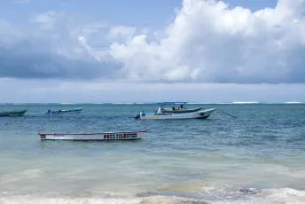
Moored Boats
Malindi
Boat on Sandbar
Malindi
Carcans plage
55400146854_6704fd97c1_k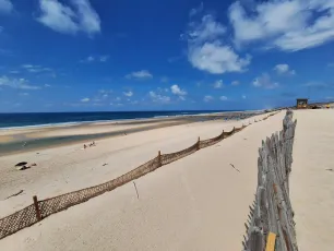
Carcans plage
55400089338_7cefbe3306_k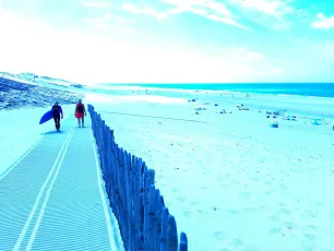
Carcans plage
55400358435_842dbbe6a8_k
A Day on the Beach, Salcombe, Devon
55399697171_e65ff014ae_k
#sfgl0008...my.favorite.beach.on.Garda.lake
#sequences.Garda.lake #sequences.last.minute #cell.camera.Leica
Un snorkler près d'une des plages de la magnifique Green Island du parc marin de la Grande Barrière de corail (Great Barrier Reef), en Australie!
Une vue à partir du quai où notre catamaran climatisé de 35 m "Big Cat" est resté amarré toute la journée lors de notre excursion sur Green Island, Queensland, Australie. Cette excursion d'observation des coraux en semi-sous-marin est organisée par l'entreprise Big Cat Green Island Reef Cruises qui propose la seule excursion de ce type à Green Island. Elle est offerte dans le cadre du "Green Island Day Trip from Cairns" qui nous amène sur l'île à bord d'un catamaran moderne. Cadeau rare de la nature, l'île Green Island est un parc national situé au sein du parc marin de la Grande Barrière de corail (Great Barrier Reef). C’est une destination populaire pour les visiteurs depuis des générations, avec des hôtes venant chaque année du monde entier pour découvrir ce site classé patrimoine mondial de l'UNESCO depuis 1981 (WHL-154). Cet ancien îlot de corail abrite plus de 120 espèces de plantes, d'oiseaux multicolores, de spécimens marins natifs de la région et de jardins coralliens à explorer. Elle existe depuis environ 6 000 ans et a été formée par une accumulation de sédiments de sable, de dépôts animaux et coralliens jusqu'au-dessus du niveau de la mer. Elle est l'un des 300 îlots de sable de la Grande barrière mais elle est la seule île corallienne de la Barrière de corail à être recouverte d'une forêt humide tropicale. Sa taille est de 15 hectares (approximativement 37 acres) et il faut environ 45 minutes pour en faire le tour à pied. Cairns est une ville de la région du nord tropical du Queensland. Elle se trouve à 2 420 km de Sydney au nord-ouest. Fondée en 1876 pour assurer le ravitaillement des mines d'or de l'intérieur, Cairns est dorénavant une ville moderne, entre les collines recouvertes par la forêt tropicale et les eaux de Trinity Bay. Située dans le Tropical North, la ville de Cairns est idéale pour se lancer à la découverte des Forêts tropicales humides du Queensland inscrites depuis 1988 sur la liste du patrimoine mondial de l'UNESCO (WHL-486) ou pour découvrir la Grande Barrière de corail, ses îles paradisiaques et sa faune marine foisonnante, aussi inscrites depuis 1981 (WHL-154). Victime de l'affluence touristique, elle a aujourd'hui perdu beaucoup de son charme tranquille et sert surtout de base pour les excursions vers la Grande Barrière de corail, la côte et l'arrière-pays. Elle offre tout de même quelques éléments intéressants dont l'Esplanade, la Cairns Regional Gallery, ses cafés et restos.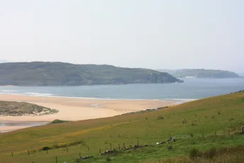
BHL1-5 Torrisdale Beach, Bettyhill, Sutherland.
BHL1-5 Torrisdale Beach, Bettyhill, Sutherland. View from Bettyhill to Skerray and Torrisdale Bay. To the right is Neave or Coomb Island with its small beach.
#sfkl0081...Tawen.beach
55398539451_27ddfbfb64_k- <a href="https://live.staticflickr.com/65535/55399569851_ba613109a6_k.jpg" title="fr.wikipedia.org/wiki/Boracay">

Boracay beach, Philippines
fr.wikipedia.org/wiki/Boracay 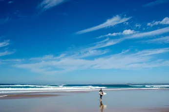
Phillip Island - Cape Woolamai
Surfer dude
PLAYA DEL FARO // MASPALOMAS / GRAN CANARIA
55399319808_2c3b7ef5db_k


The above example uses the following, generated shortcode (how to use):[$justified_image_grid preset=13 lightbox=foobox mobile_lightbox=foobox max_rows=5 flickr_user=9585587@N08 flickr_group=1172962@N22]
What makes a Flickr Group pool useful?
It gives you the most control as group administrator by moderating photos and people. Work with 3rd party content, while having the appropriate control over all of which you'll eventually sync to WordPress.
- Load photos from public or invite-only groups (you or the added user must be a member). Private groups are not supported.
- If you are the group administrator, have full control over all content added to your Flickr Group pool.
- Display up to 500 of the latest photos from the desired pool.
- Learn more on the Flickr Groups FAQ page or at the new, shorter Yahoo help article about Flickr group administration.
How do the settings look like?

Flickr

Flickr