Lake-Placid_Upstate-New-York_Herb-Brooks-National-Hockey-Center_6-17-2024_Sam-Knaus_2
54476163210_ac89610f29_b

Aquamarine Spring Colors of Cape Cod...
At Nobska Light in Quissett...

Pelican Silhouette
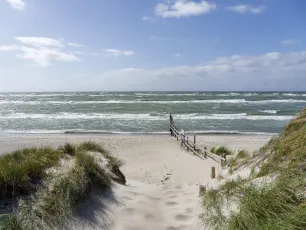
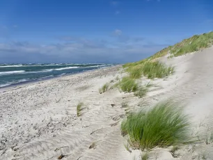
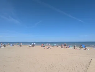
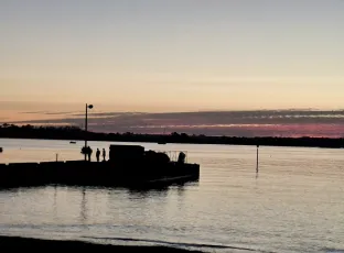
Neshotah Beach, Two Rivers, Wisconsin

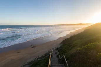
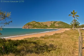
North Stradbroke Island, Queensland
North Stradbroke Island (Minjerribah), colloquially Straddie or North Straddie, is an island that lies within Moreton Bay in the Australian state of Queensland, 30 kilometres southeast of the capital Brisbane. Before 1896 the island was part of the Stradbroke Island. In that year a storm separated it from South Stradbroke Island, forming the Jumpinpin Channel. The Quandamooka people are the traditional owners of North Stradbroke island.
At 275.2 square kilometres, it is the second largest sand island in the world. On the island there are three small towns, a number of lakes and beaches along most of the seaward coastline with rocky outcrops at Point Lookout. An Aboriginal presence on the island has been long and ongoing, resulting in a successful native title determination. Tourism is a major and growing industry on the island. Source: en.wikipedia.org

Norway / Nordland / Lofoten / Vestvågøya - Myrland
Norwegen / Nordland / Lofoten / Vestvågøya - Myrland
Midnight twilight
Mitternachtsdämmerung
Vestvågøya (or less-commonly: Vest-Vågøy) is an island in the Lofoten archipelago in Nordland county, Norway. The island is located within Vestvågøy Municipality. The island lies between the islands of Austvågøya and Gimsøya to the northeast and Flakstadøya to the southwest. There are also several small islands and skerries surrounding the island. Vestvågøya makes up over 97% of the municipal area and about 99% of the inhabitants of the municipality live on the island. The European route E10 highway crosses the island connecting to Flakstadøya by the Nappstraum Tunnel and to Gimsøya by the Sundklakkstraumen Bridge.
The middle part of the island is relatively flat and marshy, while the outer parts in the north and south are mountainous. The highest point on the island is the 964-metre (3,163 ft) tall mountain Himmeltindan. The flat parts of the island are largely agricultural land. There is one town on the island (Leknes) and several large villages on the island including Stamsund, Ballstad, and Gravdal.
In Vestvågøya mountains have steep slopes towards the open sea in the northwest and southeast while slopes pointing towards the interior of the island are more gentle. This is the result of erosion acting on a landscape that has been uplifted along southwest-northwest-trending faults in the margins of Lofoten while the interior axis has remained more stable.
(Wikipedia)
Vestvågøya (seltener Vest-Vågøy) ist eine Insel der norwegischen Inselgruppe Lofoten. Die Insel gehört zur Kommune Vestvågøy im Fylke Nordland. Mit einer Fläche von 413,28 km² ist sie die zwölftgrößte Insel des norwegischen Hauptlandes.
Geografie
Die Insel ist Teil der vor der norwegischen Westküste gelegenen Inselgruppe Lofoten und liegt nordöstlich der Insel Flakstadøya und südwestlich der Gimsøya. Von der Flakstadøya ist die Vestvågøya durch die Meerenge Nappstraumen getrennt, von der Gimsøya über den Sundklakkstraumen. Die Vestvågøya liegt vollständig in der Kommune Vestvågøy und macht etwa 97 % des Gemeindeareals aus. Zudem leben über 99 % der insgesamt 11.619 Einwohner (Stand: 1. Januar 2024) der Kommune auf der Insel.
Die Insel ist teils von Mooren bedeckt. Die Küste ist von einer Vielzahl an Fjorden und Buchten geprägt. Auf der Insel befinden sich mehrere Erhebungen mit über 700 moh. Teils ist die Küste steiler abfallend, bei der Stadt Leknes an der Südküste liegt ein breiterer Küstenstreifen vor. Die Erhebung Himmeltindan an der Westküste stellt mit einer Höhe von 962 moh. den höchsten Punkt der Kommune Vestvågøy und damit auch der Insel dar. Die Berge schirmen die Insel teilweise vor Wind und Regenfronten ab. Das Klima entspricht einem maritimen Klima, das zu milden Wintern führt.
Verkehr
Über die Insel führt die Europastraße 10 (E10), die die Anbindung ans Festland herstellt. Im Nordosten führt sie über eine Brücke auf die Gimsøya, im Südwesten durch einen Tunnel auf die Flakstadøya.
(Wikipedia)

seaside
55299254239_248d128f94_h

Korfovounia Beach, Agios Stefanos Kassiopi
55299290615_954a6fdf0d_k

Las Playitas Yesterday
55297151889_f8f4a81901_k

Saint-Malo
54895100499_915ab4408d_b

The Eagle as it sails through Lewis Bay and
out toward Nantucket Sound for the 2 1/4 hour crossing...

Shoreline at Las Indias La Palma
A typical view from the edge of the holiday resort of Las Indias. Not a place for swimming, but to watch the force of the waves, and marvel at the colour of the sea.
At times, sitting at the pool, one could feel the sea spray...

Morning views at the seaside with clouds and a blue sky
Palm Beach with blue Sky and clouds on the. Northern Beaches of Sydney, NSW, Australia.

DSC_7757: Golden sun dips toward the horizon, casting a shimmering path across calm waters as evening settles over a quiet shoreline.
A serene sunset scene unfolds along the shoreline in Ban Chang, Rayong Province, Thailand, where the golden sun hangs low in a hazy sky, casting a brilliant shimmering reflection that stretches across the calm waters toward the sandy beach in the foreground. The warm orange and amber tones of the sky gradually fade into softer hues near the horizon, where silhouetted landforms and small boats dot the distant seascape. To the right, the dark outline of a building and palm trees emerges from a tree-covered headland, adding depth and a sense of place to the tranquil composition. Gentle waves lap against the wet sand, which glistens with reflected sunlight, while two small figures can be faintly seen wading in the shallows, enhancing the peaceful, contemplative mood of this quiet evening by the sea.

DSC_3498: Toes in the tide, playful waves washing over sandy feet at the water's edge.
A close-up, ground-level photograph captures a pair of bare feet planted in wet sand at the water's edge, as a frothy wave rushes in and swirls around the ankles. The bubbly white sea foam churns dynamically across the frame, partially obscuring the feet and creating a sense of motion and playfulness. Tiny droplets of water splash up from the surf, frozen in mid-air, while the damp, compact sand stretches across the foreground in soft beige tones. The intimate perspective and natural lighting evoke a carefree, sensory moment of someone enjoying the simple pleasure of standing in the shallow tide along the shores of Pattaya Beach in Thailand.

Praia do Leblon no Rio de Janeiro
Leblon - Rio de Janeiro - Brasil

Wet Low Tide Sunrise. Taholah, WA.
55297966169_fce3e5a08c_k

classic VP
Gray's Beach
Yarmouth, Massachusetts

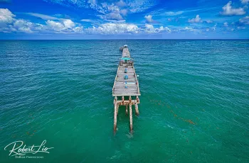
William O Lockhart Municipal Pier & Benny's on the Beach Restaurant, 10 Ocean Boulevard, Lake Worth Beach, Florida, USA / Rebuilt: 2009
This pier was rebuilt recently. The Gulf Stream current comes right to Lake Worth Beach, bringing species you don’t typically find close to shore right into the surf.
It's the first place an angler caught a sailfish from land. When the northwest winds blow in winter, a few diehard anglers launch live baits clipped to kites and fly the baits out to deeper water.
This pier is also a legendary snook fishing spot. Plenty of pompano, cobia and snappers are caught as well. You can rent tackle and buy bait right there as well.
The hurricane seasons of 2004 and 2005, were especially damaging for Lake Worth. The fishing pier was smashed by 3 storms: Hurricanes Frances, Jeanne and Wilma. The pier reopened in 2009 and self funds with modest entry fees for sightseers ($1.00) and fisherman ($3.00). The rebuilt pier has been raised 5 feet. The surfing in Lake Worth is consistently good, as a result of the sandbars created by the pier.
Situated on this pier is a restaurant called Benny's on the Beach, established in 1986, Benny's on the Beach has been a staple of Lake Worth Beach and continues its great reputation as of today.
Benny's features the best breakfast in Palm Beach County. Conveniently located right on the pier of Lake Worth, Benny's on The Beach offers not only amazing food but the one of the nicest views in all of South Florida. Known for the delicious french toast, pancakes, and eggs benedict, Some of their best sellers include Nutty Almond french toast, Stuffed Red Raspberry french toast, Lobster benedict, as well as our humongous three egg omelets.
Benny's also serves up an amazing lunch with some of the freshest seafood around. Appetizers include our world famous Calamari, Garlic Steamed Clams, and our delicious Mussels served in a creamy garlic sauce that is sure to keep you coming for more. Benny's also serves the best gyro pita, burgers, salads, and fresh seafood.
Established in 1986, Benny's on the Beach has been a staple of Lake Worth and continues its great reputation for 27 years and counting
Credit for the data above is given to the following websites:
www.visitflorida.com/en-us/things-to-do/florida-fishing/p...
beachspot.org/surf-the-pier-at-lake-worth-beach-places-to...
www.yelp.com/biz/bennys-on-the-beach-lake-worth
© All Rights Reserved - you may not use this image in any form without my prior permission.

Norderney
51952069387_0cd21b30c2_k

Heute Morgen Am Neudorfer Werder...
55296688083_edd02dc6d8_k

Italy / Tuscany - Monte Argentario
Italien / Toskana - Monte Argentario
Riserva naturale Duna Feniglia
Monte Argentario is a comune (municipality) and a peninsula belonging to the Province of Grosseto in the Italian region Tuscany, located about 150 kilometres (93 mi) south of Florence and about 35 kilometres (22 mi) south of Grosseto. The peninsula is connected with the mainland by three spits of land which form two lagoons, the Laguna di Ponente on the west side and the Laguna di Levante on the east side of the middle dam. The two main villages on Monte Argentario are Porto Santo Stefano, chief town, facing north, and Porto Ercole facing south.
The panoramic road Strada panoramica starts in Porto Santo Stefano allowing splendid views of the coast and the Tuscan Archipelago.
Monte Argentario borders the comune of Orbetello, which is located on the middle dam between the two lagoons.
Geography
Monte Argentario is a promontory stretching towards the Tyrrhenian Sea in correspondence of the two southernmost islands of the Tuscan Archipelago, Giglio and Giannutri. The promontory was an island in the past, but the sea currents and the Albegna river joined it with the mainland through two so-called tomboli (stretches of land), the Tombolo of Giannella and the Tombolo of the Feniglia.
The highest peak of Monte Argentario is the Punta Telegrafo at 635 metres (2,083 ft) above sea level. The landscape and the coast are mainly rocky, with numerous harbors, usually with rock beaches. The municipal seat is in the northern settlement, Porto Santo Stefano. The other main settlement in the township is Porto Ercole.
Argentarola cave lies close to Argentario promontory. The high quality speleothems that have been collected from this cave have allowed scientists to study the 215,000 year history of sea-level oscillations in this region.
History
The promontory, probably already inhabited by the Etruscans, was a personal property of the Domitii Ahenobarbi family, who obtained it in return for the money they lent to the Roman Republic in the Punic Wars. The current name probably finds its origin here, since Argentarii was the name of money lenders in ancient Rome.
Later an imperial possession, it was ceded to the church by Constantine the Great in the 4th century AD. In the Middle Ages, due to the reduced traffic passing on the nearby Via Aurelia, the area was sparsely settled. In the heart of the Middle Ages, the promontory became a possession of the Monastery of San Paolo in Rome. It represented in the so-called Carolingian Gate at the Monastery of St. Anastius outside Rome. Following the history of Orbetello, the promontory was a possession of the Aldobrandeschi, the Orsini, King Ladislaus of Naples and Siena, until Spain acquired it in the late 16th century. The Spaniards heavily fortified the two ports, as the main stronghold of the State of Presidi. In 1815, after Napoleon's defeat, the Argentario was handed over to the Grand Duchy of Tuscany, to which it belonged until 1860, when it became part of the newly united Kingdom of Italy.
The painter Michelangelo Merisi, known as Caravaggio, died of a fever at Porto Ercole in 1610.
During World War II, the settlements of Argentario were heavily bombed, with numerous losses. The port of Santo Stefano was destroyed, and was rebuilt only in the 1950s. The railway that connected Orbetello to the mainland was never rebuilt.
Main sights
Monastery of the Presentation and Punta Telegrafo.
Rocca Spagnola (Spanish Fortress), in Porto Santo Stefano.
Forte Filippo and Forte Stella, in Porto Ercole.
The church of St. Erasmus, in the historical centre of Porto Ercole, not far from the Porta Pisana.
The Via panoramica (Panoramic Road), running alongside the coast.
Argentario Aquarium
(Wikipedia)
A protected area that separates the open sea from Lake Orbetello: the Duna di Feniglia Nature Reserve is ideal for a day of immersion in nature, with family, alone or as a couple! It is free of charge and open all year round.
Whether on foot or by bike (rental is available) you can take long walks in the shade of the pine trees, and meet local inhabitants, starting with the fellow deer. If you then walk silently into the pine forest you can also see wild boars and foxes and, looking up at the treetops, also the nests of gray herons.
Every kilometer there is a path leading to the sea with its sandy beaches and crystal-clear waters, where you can spend the day. Lovers of outdoor sports, in addition to being able to walk 6km of pine forest on an unpaved road, will also have a path of wooden gymnastic equipment available.
On the side overlooking the lagoon there are paths equipped with huts to observe animals. There is also the “nature” trail, organized by the WWF, also suitable for people with a visual impairment: these are fifteen stages, equipped with handrails and descriptions in Braille, where are explained the characteristics of the flora and fauna living in the Dunes. It is a unique experience, because it gives everyone the opportunity to immerse themselves and discover nature with all their senses, perceiving what surrounds us with smell and hearing.
In the past the Feniglia Dune belonged to private owners who intensively exploited its territory leading to deforestation, resulting in health problems due to the formation of swampy areas that favored the proliferation of the malaria-carrying mosquito. In 1910 the Dune was expropriated and entrusted to the management of the State Forestry Corps which encouraged the rebirth of vegetation by reforesting about 450 hectares.
Today the Feniglia Dune is a Forest Reserve: visiting and enjoying this place therefore requires the utmost respect for nature and the environment.
(destinationcapalbio.com)
Monte Argentario ist eine italienische Gemeinde mit 12.040 Einwohnern (Stand 31. Dezember 2022) in der Provinz Grosseto am Südrand der Toskana. Sie umfasst die namensgebende Halbinsel Monte Argentario an der Küste des Tyrrhenischen Meeres.
Geografie
Der Monte Argentario ist ein annähernd kreisrundes felsiges Vorgebirge, dessen höchste Erhebung (der Monte Telegrafo) 635 m aufweist. Er war in der Antike eine vom offenen Meer umgebene Insel, an der sich später durch den von dem Fluss Albegna mitgebrachten Schlamm, Sand und Schutt drei Landzungen zum Festland bildeten, die heute das Wasser in der so genannten Lagune von Orbetello umschließen.
Der Zugang zum Monte Argentario vom Festland erfolgt entweder, von Albinia kommend, über die nördliche Nehrung (Tombolo di Giannella) oder über die mittlere, als Damm artifiziell verstärkte Landzunge von Orbetello. Die südliche Nehrung Tombolo di Feniglia ist für PKW gesperrt, Teile davon haben den Status einer 'Riserva naturale' mit entsprechenden Zugangsbeschränkungen.
Zwischen den zerklüfteten Felsen des Felsgebirges wachsen Pinien und die charakteristische Macchie-Vegetation. Kleine sandige Strände erstrecken sich schwer zugänglich tief unterhalb der Steilküsten. Weite Teile der Landschaft außerhalb der beiden Küstenorte auf der „Insel“ sind naturbelassen.
Gemeindegliederung
Porto Santo Stefano, capoluogo (Hauptort)
Porto Ercole, frazione (Ortsteil)
Beide Hafenorte zeichnen sich durch umfangreiche Befestigungen aus spanischer Zeit aus.
Weitere Ortsteile (frazioni) sind Cala Moresca, Cala Piccola, Carrubo, Pozzarello, Santa Liberata, Sbarcatello und Terrarossa.
Die einzige Nachbargemeinde ist Orbetello auf dem mittleren Damm, der als Zufahrtsstraße dient.
Geschichte
Ob das Vorgebirge bereits von den Etruskern besiedelt war, kann nicht einwandfrei verifiziert werden. Jedenfalls wurden zum Bau des Hafendamms von Orbetello etruskische Polygonalquader verwendet. Strabon gibt Zeugnis von einem Hafen Portus Cosanus; möglicherweise besteht eine Verbindung zu Cosa, einem 273 v. Chr. südlich der Lagune bei dem heutigen Ansedonia von den Römern gegründeten Hafen mit etruskischer Vorbesiedlung. Eindeutig dokumentiert ist der spätere Besitz durch die römische Familie der Domitii Ahenobarbi, die das Gebiet als Entschädigung für Darlehen an die römische Republik während des Zweiten Punischen Krieges erhielt. Bei dieser Familie handelte es sich um Argentarii (Silber/Geld Besitzende = Darlehensgeber); von dieser Berufsbezeichnung rührt nach herrschender Meinung der Name des Gebirgszuges.
Verschiedene römische Kaiser hatten das Territorium in Besitz, ehe Konstantin es im 4. Jahrhundert der Kirche schenkte. Im Mittelalter verlor das Gebiet an Bedeutung, mutmaßlich bedingt durch die verfallende Infrastruktur in der zunehmend versumpfenden Maremma des Umlands.
Grundsätzlich teilte die Insel die Geschichte von Orbetello: Nach wechselndem Besitz durch die Feudalherren der Aldobrandeschi, der Orsini und durch Ladislaus von Neapel fiel es schließlich an Siena. Als Cosimo I. de’ Medici Siena 1555 eroberte, das die spanischen Habsburger zu jenem Zeitpunkt schon drei Jahre besetzt hielten, gehörte der Monte Argentario zu den wenigen Gebieten, die Florenz nicht für das neu zu etablierende Großherzogtum Toskana behalten durfte. Im Vertrag vom 3. Juli 1557 mit Philipp II. verlangte der König es zusammen mit Piombino, Talamone und Teilen von Elba für sich zurück.
Der Stato dei Presidi (spanisch bis 1708, österreichisch bis 1737, danach bourbonisch) bestand bis 1801, danach eroberte ihn Napoleon Bonaparte. Im Wiener Kongress 1815 fiel er an das Großherzogtum Toskana, das 1860 im Nationalstaat Italien aufging.
1824 wurde eine Straße von Orbetello über die Lagune zum Monte Argentario gebaut.
Der Ausbau des Monte Argentario zu einem Ferienzentrum setzte nach dem Zweiten Weltkrieg ein. Hotels, Appartements und Gaststätten werden sowohl in den beiden Küstenorten Porto Santo Stefano und Porto Ercole als auch an schwerer zugänglichen Felskaps an der Panoramastraße rund um den Gebirgsstock angeboten. Im Binnenland wird auch Agrotourismus betrieben. Obwohl die Region im Sommer gut besucht ist, gibt es keinen Massentourismus. Einerseits haben Umweltschützer eine großflächige Bauspekulation verhindert und andererseits sind weite Teile der zerklüfteten Küste als weiträumig eingezäunte und geschützte Residenzen vermögender Privatiers und internationaler Prominenz eigengenutzt.
Panoramastraßen
Fährt man den Monte Argentario von Norden (Orbetello) über den Lagunendamm an, lässt sich die Panoramastraße (Strada Panoramica) sowohl nach Südwesten über Porto Santo Stefano hinaus als auch nach Südosten über Porto Ercole hinaus ein Stück befahren. Eine Umrundung des gesamten Gebirgsmassivs ist mit einem normalen PKW nicht zu empfehlen, da beide Enden der asphaltierten Straße nur von einer schmalen Schlagloch-Piste verbunden werden.
Die Panoramastraße verläuft durch die Steineichen-, Baumheide-, Ginster- und Zistrosen-Macchia hoch über den Buchten und kleinen Stränden mit bizarren Felsformationen, Kaps und kleinen Felseninseln, Wachttürmen auf den Spitzen im Binnenland und weiten Ausblicken auf die Nachbarinseln Giglio und Giannutri, bei klarem Wetter auch auf Elba und Montecristo, bei besonders guter Sicht sogar bis Korsika. Der Zugang zum Meer ist für die Öffentlichkeit wegen vieler weitgehend in Privatbesitz befindlicher, abgezäunter Grundstücke nur an wenigen Stellen möglich.
Eine asphaltierte Querverbindung durch das Binnenland sichert vor dem südwestlichen Straßenende eine verkürzte Rückkehrmöglichkeit nach Porto Santo Stefano.
Außerdem führt vom Osten her eine Straße auf den Monte Telegrafo. Hier passiert man das Passionistenkloster (Convento dei Frati Passionisti) auf einem Hügel, von dem sich bei gutem Wetter eine Fernsicht nördlich über die Lagune von Orbetello hinaus bis nach Talamone am Südrand des Parco Naturale della Maremma öffnet. Auch von weiteren Aussichtspunkten an dieser Straße, z. B. von einem riesigen Kreuz, das nachts beleuchtet wird, bieten sich weite Ausblicke. Auf dem Gipfel befinden sich Sendeanlagen der RAI und auf dem höchsten Punkt eine militärische Anlage (daher nicht zugänglich).
Wirtschaft
Im 20. Jahrhundert hat der Tourismus den Fischfang als Haupteinnahmequelle abgelöst. Die Fischbestände wurden dezimiert und die Fischer müssen in immer weiter entfernt gelegene Fanggründe Richtung Sardinien ausgreifen.
In geringem Umfang wird das Binnenland im Bereich von Porto Santo Stefano auf Flächen zum Zuckerrohr-, Gemüse- und Weinanbau in Terrassenfeldkultur genutzt.
Haupteinnahmequelle ist jedoch der Tourismus, wobei weniger Touristen aus Deutschland zu finden sind, als Italiener, insbesondere aus Rom und Florenz, die hier ihre Sommervillen haben.
(Wikipedia)
Ein Naturschutzgebiet, das das offene Meer von dem Orbetello-See trennt: Duna di Feniglia ist das Ideal für einen Tag in der Natur mit der Familie, allein oder zur zweit! Es ist kostenlos und ganzjährig geöffnet.
Zu Fuß oder mit dem Fahrrad (Verleih ermöglicht) können Sie im Schatten der Kiefern lang spazieren gehen und den Einheimischen, wie den Damhirschen, begegnen. Wenn Sie dann ruhig in den Kieferwald vorstoßen, können Sie auch Wildschweine und Füchse erblicken und, wenn Sie zu den Baumkronen hinaufschauen, die Nester von Graureiher.
Jeder Kilometer finden Sie Pfade, die zu dem Meer, zu seinen Sandstränden und seinem kristallklaren Wasser führen. Hier können Sie den ganzen Tag verbringen!
Liebhaber von Freiluftsporten können 6 Kilometer Kieferwald auf einem ausgehobenen Weg sowie hölzerne Trimm-dich-Pfade genießen.
Auf der Seite vor der Lagune befinden sich Wege mit Hütten zur Tierbeobachtung. Es gibt auch einen vom WWF organisierten Naturlehrpfad für Sehbehinderte: es handelt sich um fünfzehn Punkte mit Handläufen und Blindenschrift-Schildern, die die Besonderheiten der Flora und der Fauna der Düne erklären.
Dies ist ein einzigartiges Erlebnis, weil es jedem die Möglichkeit gibt, in die Natur einzutauchen und sie mit allen Sinnen zu entdecken, indem man die Umgebung mit dem Geruch und dem Gehör wahrnimmt.
In der Vergangenheit gehörte die Duna di Feniglia zu Privateigentürmen, die das Land so intensiv ausgenutzte, dass es Entwaldung verursachte. Die Bildung von Sumpfgebieten begünstigt die Verbreitung der malariaübertragenden Stechmücke, ist Grund von verschiedenen Gesundheitsprobleme wegen
In der Vergangenheit gehörte die Duna di Feniglia zu Privateigentürmen, die das Land so intensiv ausgenutzte, dass es zur Entwaldung und damit zu Gesundheitsprobleme führte, da das Entstehen der Sumpfgebiete hat die Verbreitung der malariaübertragenden Stechmücke begünstigt.
1910 wurde die Düne enteignet und der Verwaltung des staatlichen Forstkorps anvertraut, das die Neugeburt der Vegetation durch Aufforstung von etwa 450 Hektare förderte.
Heutzutage ist die Duna di Feniglia ein Waldschutzgebiet: der Besuch und der Genuss dieses Ortes erfordern daher den größtmöglichen Respekt der Natur und der Umwelt.
(destinationcapalbio.com)

This Morning on the Elberadweg...
55296920260_650d9ad3df_k

Remataki beach next to Pythagoreion, Samos Isl.
This is a B/W photograph of the the beach called Remataki. It is situated next to the town Pythagoreion on Samos Island, Greece.

Heute Morgen Auf Dem Elberadweg...
55296651473_44af3d0dc2_k

Bajamar
Cantábrico

Neshotah Morning
Neshotah Beach, Two Rivers, Wisconsin

Full Moon
"Barra do Sahy", São Sebastião, São Paulo, Brazil.

Sunset at Étretat
Surrounded by cliffs, the beach of Étretat is relatively sheltered from prevailing winds.
This is a popular place to watch the sun set over the horizon.
The beach is made up of pebbles. These pebbles are a natural bulwark, necessary to protect the coastline. In fact, they contribute to this protection by acting as a "wave damper", in the same way as artificial stonework would.

Aspalathra Beach, Agios Stefanos Kassiopi
55295836977_1c67a11f28_k

Agios Stefanos Kassiopi, Kassiopeia
55295835602_c0bc3e6100_k

A Turkish View
Looking across to Turkey/Turkiye from the beach at Ialysos on Rhodes.

All that glitters is not gold
55296569521_42155a9005_k

Koh Kham Sandbar
At low tide a white sandbar emerges, almost connecting the two shores through shallow turquoise water.

Remataki beach next to Pythagoreion, Samos Isl.
This is a color photograph of the the beach called Remataki. It is situated next to the town Pythagoreion on Samos Island, Greece.

Málaga_02719
42765894920_ddbfeaf463_k

Plage St Antoine
55296301051_9095a8fee2_b

Norderney 2026
55296508949_e1a7187e98_k

North Stradbroke Island, Queensland
North Stradbroke Island (Minjerribah), colloquially Straddie or North Straddie, is an island that lies within Moreton Bay in the Australian state of Queensland, 30 kilometres southeast of the capital Brisbane. Before 1896 the island was part of the Stradbroke Island. In that year a storm separated it from South Stradbroke Island, forming the Jumpinpin Channel. The Quandamooka people are the traditional owners of North Stradbroke island.
At 275.2 square kilometres, it is the second largest sand island in the world. On the island there are three small towns, a number of lakes and beaches along most of the seaward coastline with rocky outcrops at Point Lookout. An Aboriginal presence on the island has been long and ongoing, resulting in a successful native title determination. Tourism is a major and growing industry on the island. Source: en.wikipedia.org

DSC_6210: Silver fireworks cascade over a moonlit sea, their sparkles mirrored on the water below.
A spectacular fireworks display lights up the night sky over the sea in Pattaya City, Thailand. Cascading silver sparks rain down like glittering willow branches, creating bright bursts of white and pale blue against the deep black sky. Plumes of smoke drift across the scene, softly illuminated by the pyrotechnics above. Below, the calm water reflects the shimmering lights, while distant shoreline lights twinkle along the horizon. A few small silhouettes of spectators can be seen near the water's edge on the right, giving a sense of scale to the dramatic, moonlit spectacle.

DSC_4663: a woman talking on a cell phone next to the ocean
The photo shows a person with long black hair wearing a black outfit near what appears to be a body of water. They are holding a phone to their ear with one hand while touching their hair with the other hand. The background shows a serene water view with a light-colored sky, suggesting this might be taken near a beach or lake. The person is carrying what looks like a bag with a gold chain strap. The overall scene has a casual yet fashionable appearance, with the natural waterside setting creating a nice contrast with the dark clothing.

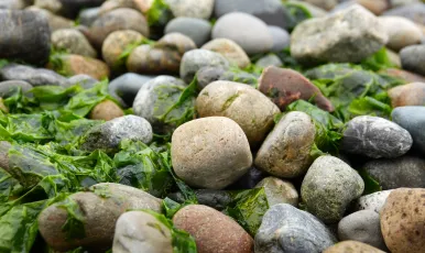
Seeweed
At low tide, the green color on the rocks becomes apparent.
"Barra do Sahy", São Sebastião, São Paulo, Brazil.

Main Beach, North Stradbroke Island, Queensland
North Stradbroke Island (Minjerribah), colloquially Straddie or North Straddie, is an island that lies within Moreton Bay in the Australian state of Queensland, 30 kilometres southeast of the capital Brisbane. Before 1896 the island was part of the Stradbroke Island. In that year a storm separated it from South Stradbroke Island, forming the Jumpinpin Channel. The Quandamooka people are the traditional owners of North Stradbroke island.
At 275.2 square kilometres, it is the second largest sand island in the world. On the island there are three small towns, a number of lakes and beaches along most of the seaward coastline with rocky outcrops at Point Lookout. An Aboriginal presence on the island has been long and ongoing, resulting in a successful native title determination. Tourism is a major and growing industry on the island. Source: en.wikipedia.org

Main Beach, North Stradbroke Island, Queensland
North Stradbroke Island (Minjerribah), colloquially Straddie or North Straddie, is an island that lies within Moreton Bay in the Australian state of Queensland, 30 kilometres southeast of the capital Brisbane. Before 1896 the island was part of the Stradbroke Island. In that year a storm separated it from South Stradbroke Island, forming the Jumpinpin Channel. The Quandamooka people are the traditional owners of North Stradbroke island.
At 275.2 square kilometres, it is the second largest sand island in the world. On the island there are three small towns, a number of lakes and beaches along most of the seaward coastline with rocky outcrops at Point Lookout. An Aboriginal presence on the island has been long and ongoing, resulting in a successful native title determination. Tourism is a major and growing industry on the island. Source: en.wikipedia.org

Derrynane beach, County Kerry, Ireland
Derrynane (Irish: Doire Fhionain, Saint Fionan's Oak Wood) is a townland in the parish of Caherdaniel in County Kerry, Ireland, located on the Iveragh peninsula, just off the N70 national primary road near Caherdaniel on the shores of Derrynane Bay.
Derrynane is the site of Derrynane House which was the home of Daniel O'Connell and now is a National Monument and part of a 320-acre (1.3 km²) National Park. Source: en.wikipedia.org/wiki/Derrynane

Main Beach, Minnie Water, New South Wales, Australia
Minnie Water is a small coastal village completely surrounded by Yuraygir National Park. The village is picture perfect when the Christmas Bells or the Flannel Flowers bloom in the surrounding parklands with over 120 species of wildflower identified around Minnie Water.
There are two short but picturesque walks in the national park: Angophora Grove Walk and Rocky Point Walk. The rock platforms extending seawards to Rocky Point offer hours of entertainment for those who enjoy examining the microcosm of marine life in tidal pools and rock crevices. Sea urchins, star fish, cunjevoi, coral and a variety of sponges and shells may be found in this area. Source: www.clarencecoastholidayparks.com.au

Tugun beach, Gold Coast, Australia
Tugun is a beach-side suburb on the Gold Coast in Queensland, Australia.
Tugun is situated at the junction of the Pacific and Gold Coast highways 7 kilometres (4.3 mi) north-west of Coolangatta and 96 kilometres (60 mi) south of Brisbane, the state capital. The junction was notoriously traffic-clogged but has improved markedly upon completion of the Tugun Bypass in June 2008.
Tugun is a popular holiday destination, with a number of holiday units and motels lining Tugun Beach. Tugun has a number of shops located on its Golden-Four Drive strip. Source: en.wikipedia.org

Kazantip, маёвка 2015
More about KaZantip
/
Больше о КаZантипе тут.
More about Crimea in my blog
/
О Крыме в моем блоге.

As the river flows
55293974352_6a35b1a7ed_k

Plage du Tremblet
D'une longueur d'environ 280 mètres, cette plage, située à Saint-Philippe, est née de la rencontre entre la coulée de lave d'avril 2007 (au fond) et l'océan Indien. Subtil mélange de sable noir et d'olivine, premier minéral à cristalliser quand le magma refroidit, elle est donc sans doute l'une des plus jeunes plages de la Terre (au fond, le quai de Sel).
About 280 meters long, this beach, located in Saint-Philippe, was born from the meeting between the lava flow of April 2007 (at the bottom) and the Indian Ocean. A subtle mixture of black sand and olivine, the first mineral to crystallize when the magma cools, it is therefore arguably one of the youngest beaches on Earth (in the background, the Salt Quay).

Plage du Tremblet : formes dessinées par les vagues
D'une longueur d'environ 280 mètres, cette plage, située à Saint-Philippe, est née de la rencontre entre la coulée de lave d'avril 2007 (au fond) et l'océan Indien. Subtil mélange de sable noir et d'olivine, premier minéral à cristalliser quand le magma refroidit, elle est donc sans doute l'une des plus jeunes plages de la Terre.
About 280 meters long, this beach, located in Saint-Philippe, was born from the meeting between the lava flow of April 2007 (at the bottom) and the Indian Ocean. A subtle mixture of black sand and olivine, the first mineral to crystallize when the magma cools, it is therefore arguably one of the youngest beaches on Earth.

City Beach
A Quiet Stretch of the Rockaway Beach in Queens,New York

By the Sea
Small waves crash against the Rockaway Beach in Queens,New York

Akoli Beach (Erimitis,) Kassiopeia
55294253531_e5e4c856d9_k

Vouvalomadria Beach (Erimitis,) Kassiopeia
55294660510_4cbe16f67c_k

Arias Beach (Erimitis,) Kassiopeia
55293281352_c492a2f61c_k

Ténérife, Playa de las Teresitas à San Andrès
55294608450_b79c7fa2b4_k

Santa Monica
55294151241_08fb10ca6f_h

Pythagoreion from West, Samos Isl.
This is a B/W photograph of the town Pythagoreio from a beach to the West of it at sunset.

The Crossing to Koh Kham
Approaching Koh Kham from Koh Mak on a bright tropical morning

Gran Canaria: Arguineguín
55290480859_42f09818ea_h

DSC_0721
55277428294_07de382558_k

DSC_0731
55282889347_2289680a97_k

DSC_0746
55286828052_08d1df1cf7_k

DSC_0764
55293972294_c50cd031c8_k

DSC_0761
55292044310_1070b7b7b2_k

DSC_0736
55282889337_d7a6adf831_k

Pythagoreion from West, Samos Isl.
This is a color photograph of the town Pythagoreio from a beach to the West of it at sunset.

Jökulsarlon - Islande
Diamond beach

Beach
Port Logan, Dumfries & Galloway
(May 2026)

Seagulls and Scheveningen from Wassenaar beach, Netherlands
P0

Sunny Day
Portpatrick, Dumfries & Galloway
(May 2026)

Twenty minutes.
I had 20 minutes before picking up pizza so I grabbed my camera, went for a quick walk and managed to see this at Lennox Head in NSW.

DSC_1007: a woman with red hair wearing a green bikini top
This photograph captures a woman posing outdoors, likely near a beach area in Pattaya City, Thailand. She has vibrant red hair styled back from her face and is wearing a teal-green bikini top with thin straps. Her pose is dynamic, with one hand raised to touch her hair while she gazes upward and to the side, creating a contemplative or dreamy expression. She wears subtle makeup that accentuates her features. The background is softly blurred, revealing lush green tropical foliage and what appears to be a light-colored building, suggesting the urban-meets-tropical environment characteristic of Pattaya. The natural lighting gives the photo a warm, soft quality typical of late afternoon photography.

DFC_5144: Sunset launch, a jet ski is pushed into the waves off Pattaya as the sky glows orange.
This is a beautiful sunset scene at a beach in Pattaya, Thailand. In the foreground, there's a white and dark-colored jet ski or personal watercraft that has been pulled up onto the sandy shore by what appears to be two people. The timing captures the golden hour, with warm orange and pink hues painting the sky as the sun sets over the horizon. The ocean stretches out before them with gentle waves lapping at the beach, and in the distance, you can see the silhouettes of several boats or ships on the water. The wet sand reflects the colorful sky, creating a mirror-like effect that adds to the serene atmosphere. The scene captures a perfect end to what was likely a day of water activities, with the jet ski being secured on the beach as day transitions to evening. The overall mood is peaceful and picturesque, showcasing the natural beauty of Thailand's coastline during sunset.

DSC_4534: A girl sits on a beachfront promenade, gazing toward the water with palms and a calm shoreline behind her.
This photo features a young woman sitting on a beach, with her legs crossed. She is wearing a black shirt and a gold bracelet, and she appears to be enjoying her time at the beach. The woman is positioned near the center of the scene, with the beach stretching out behind her.
There are a few other people in the background, but the woman in the black shirt is the main focus of the image. The beach setting, along with the presence of other people, suggests a relaxed and leisurely atmosphere.

DSC_1033: a woman with red hair posing for a picture
This photograph captures a woman with vibrant red hair posing on a sandy beach, likely in Pattaya, Thailand. She is leaning forward toward the camera with a smile, wearing a turquoise/teal bikini top. Her makeup is notable, featuring dramatic winged eyeliner and red lipstick that complements her bold hair color. The background is artfully blurred with a shallow depth of field, showing soft bokeh effects from what appears to be beachside surroundings, with hints of greenery and possibly distant figures or structures. The warm, natural lighting suggests the photo was taken during late afternoon, giving the photo a relaxed, vacation-like atmosphere typical of Thailand's popular coastal destinations.

Genipabu dunes
The perfect view of the Genipabu dunes

Praia do Leblon no Rio de Janeiro
Leblon - Rio de Janeiro - Brasil

Spring on the Cape Cod National Seashore..
Next Stop: Spain.

Portballintrae Beach
Runkerry house in the distance on a beautiful September evening.

DSC_4499: A row of mannequins dressed in colorful bikinis and swimwear on display.
This photograph captures a vibrant display of mannequins lined up in a row, each dressed in colorful bikinis and swimwear, likely at a beachwear shop in Pattaya, Thailand. The torso mannequins are arranged in a receding perspective that draws the eye down the line, creating a striking visual rhythm of bright colors and shapes. In the foreground, a coral pink bikini with delicate strap details and a matching sarong stands out prominently, while behind it a parade of swimsuits in lavender, orange, blue, black, pink, purple, and teal create a kaleidoscope of summer hues. The headless, armless mannequins are suspended or mounted closely together, emphasizing the abundance of merchandise typical of the bustling tourist markets in this Thai beach destination.

DFC_3882: Silhouetted palm trees and beachgoers frame a fiery sun sinking into the calm ocean at sunset.
This photo captures a beautiful beach sunset scene. The silhouette of palm trees frames the view, with their distinctive fronds creating a classic tropical ambiance. The sun is setting over a calm body of water, painting the sky in warm orange and golden hues that fade to blue. In the foreground, there are silhouettes of people enjoying the beach at sunset, with some figures visible along the shoreline. A flag can be seen waving in the distance, possibly marking a beach facility or resort area. The overall mood of the photo is peaceful and serene - a perfect representation of a tranquil tropical evening by the sea. The contrast between the dark silhouettes and the vibrant sunset creates a striking visual effect that's characteristic of beach sunset photography.

Gestern vom Elbufer...
Komplett ueber...

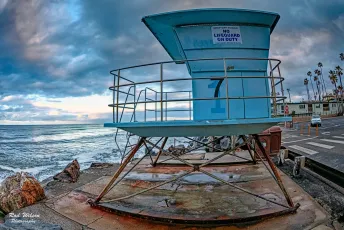
Lifeguard Post on Brighton Beach
55289531755_eb7ee6d638_k

Vamos a La Playa
Caraíva - Bahia - Brasil

Thorpe Bay Beach
Southend Pier on the horizon

Beadnell Bay
The rugged Northumberland Coastline.

Plage de Stokksnes
Islande

DFC_5152: Sunset over Pattaya beach - colorful inflatable rides resting on the sand as the evening sky glows.
This photo shows a beach scene at sunset or sunrise in Pattaya, Thailand. The main focus is a large inflatable water toy or ride shaped like a pink cartoon character (possibly resembling Hello Kitty or a similar cute mascot) with big round eyes and what appears to be a watermelon or fruit design on its face. The inflatable is positioned on the sand near the water's edge. In the background, there are several colorful boats or watercraft pulled up onto the beach, including what appears to be jet skis or small boats in yellow and blue colors. The sky displays beautiful sunset colors with soft pink, purple, and golden hues reflecting off the calm ocean water. The beach setting appears to be a popular tourist area, likely used for water sports and recreational activities during the day. Various equipment and beach gear can be seen scattered around the inflatable attraction. The serene evening atmosphere and the whimsical inflatable create an interesting contrast between the peaceful sunset and the playful beach entertainment typical of Thailand's resort destinations.

DSC_5155: a woman in a bikini sitting on a ledge
This photo features a woman sitting on a concrete ledge or wall, wearing a bikini. She is posing for the camera, possibly on a beach or near the ocean. The woman appears to be relaxed and enjoying her time.
In the background, there are a few cars parked, with one car located on the left side of the scene and two others on the right side. Additionally, there are two other people in the scene, one standing near the left edge of the image and another person closer to the center.

DFC_1411: A group of men in matching blue camo shirts and hats stand under palm trees, talking around a table with equipment and a banner as they prepare for an outdoor event.
The photo shows a group of people gathered outdoors, with palm trees visible in the background suggesting a tropical setting. Several individuals are wearing blue tie-dyed or mottled shirts that appear to be uniforms or team clothing. One person has their back to the camera and is wearing a dark shirt with the number "96" visible and some text that includes "Super." There's a partial view of what looks like a banner or sign with "HOUSE" visible and yellow lettering that appears to say "NYAR" (possibly part of a business or venue name). The setting appears to be casual, possibly at some kind of outdoor event or gathering near a beach or resort area.

DFC_5141: Twilight on Pattaya Beach, evening lights begin to glow as locals and visitors stroll the shoreline with the city skyline rising in the distance.
This photo captures a scenic beachfront view in Pattaya, Thailand during what appears to be the golden hour or early evening. The photo shows: **Beach Scene:** - A wide sandy beach with gentle waves lapping at the shore - Several beachgoers scattered along the coastline, some sitting and relaxing - Beach umbrellas and chairs visible on the sand - Palm trees and lush vegetation lining the beach **Cityscape:** - A dramatic skyline of modern high-rise hotels and condominiums in the background - Multiple tall buildings creating an impressive urban silhouette - The buildings appear to be typical of Pattaya's developed beachfront area **Atmosphere:** - Soft, dusky lighting with a pinkish-purple sky suggesting sunset or twilight - Calm sea conditions with small waves - A peaceful, resort-town ambiance This appears to be one of Pattaya's main beaches, likely Pattaya Beach, which is known for its combination of urban development and beachfront recreation. The photo beautifully captures the contrast between the natural coastal environment and the modern tourist infrastructure that Pattaya is famous for.

"Cacher de soleil", Saint-Malo
55285961958_dbe21b36df_k

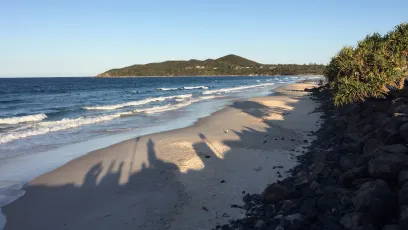
Wategos Beach, Byron Bay, New South Wales
Located just north west of Cape Byron and the lighthouse, Wategos Beach is one of Byron’s best places to picnic, paddle and play.
You’ll adore the peaceful beauty of this sheltered beach on the northern side of Cape Byron. Protected by the headland from the wilder waters beyond, it’s a fabulous spot to picnic and play. The local bottlenose dolphins use it for recreation as well, showing off their silky surfing skills on the incoming waves. Read more: www.nationalparks.nsw.gov.au

Looking Too Closely
Boipeba 2026

Formentera
Formentera is the smallest and most tranquil inhabited island of Spain’s Balearic Islands in the Mediterranean Sea, widely celebrated for its Caribbean-like turquoise waters and laid-back bohemian vibe.
Spain

O'Side Brilliant Pacific Sunset 80D 24X105mm
SoCal Brilliant Oceanside Pacific Sunset
A Wonderful Part Of Life, Is
Sharing Things You Love
With People, Like Beautiful
Photographic Moments,
Every Picture Tells
A Story.

Avlaki East Beach (Erimitis,) Kassiopeia
55286259021_e66f319d61_k

Avlaki Beach (Erimitis,) Kassiopeia
55286665580_e488ab90f4_k

The harbor seal (Phoca vitulina)
Балтийский тюлень