A Flickr Group pool is filled by photos of people who add content regularly. These are excellent source of new photos from a smaller community you trust. Justified Image Grid can pull photos from a public Flickr Group pool. Once somebody posts new content into the group, the gallery on your site updates itself automatically. It's great to show the latest content from a given group. Create an invite-only Flickr group to allow trusted people to add photos to your site. Create contest using this setup, or aggregate photos from an event by encouraging people to upload their photos to your Flickr Group pool - and show those on your site.
Displaying the Flickr Group pool: "Beaches of the World (geotagged)"
Check out this group on Flickr too!

Escultura "El Beso" (O Beijo), Victor Delfín. Parque del Amor, Miraflores,Lima.
55362076749_e67be13581_k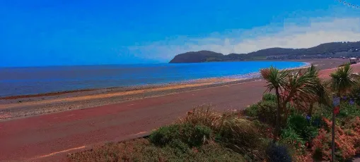
LLANDUDNO
Llandudno a premier Victorian seaside resort in North Wales. Famous for it's seafront Hotels and the dramatic backdrop of The Great Orme limestone headland
Llandudno
Sunset light over Llandudno Victorian pier,while we were on a short break during the heatwave in June 2026
LLANDUDNO
Beautiful views in the evening sunset of Llandudno and the Pier in the distance.
LLANDUDNO
Beautiful views of Llandudno from walking near our Hotel. Very hot temperature over the days we were there, we were lucky !! Llandudno is located on the shores of the Irish Sea and sits on the Creuddyn peninsula.
Wild
Leica M6 / Summarit-M 35mm f2.5 / Ilford HP5 Super Porthmeor Beach, St Ives, Cornwall, UK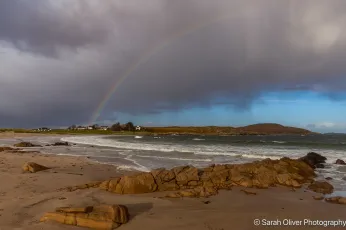
Rainbow over Mellon Udrigle Beach
Wester Ross, Scotland- <a href="https://live.staticflickr.com/5620/30708532436_d2e857d60f_k.jpg" title="Located just north west of Cape Byron and the lighthouse, Wategos Beach is one of Byron’s best places to picnic, paddle and play.
You’ll adore the peaceful beauty of this sheltered beach on the northern side of Cape Byron. Protected by the headland from the wilder waters beyond, it’s a fabulous spot to picnic and play. The local bottlenose dolphins use it for recreation as well, showing off their silky surfing skills on the incoming waves.
Source: www.nationalparks.nsw.gov.au">
Wategos Beach, Byron Bay, New South Wales
Located just north west of Cape Byron and the lighthouse, Wategos Beach is one of Byron’s best places to picnic, paddle and play. You’ll adore the peaceful beauty of this sheltered beach on the northern side of Cape Byron. Protected by the headland from the wilder waters beyond, it’s a fabulous spot to picnic and play. The local bottlenose dolphins use it for recreation as well, showing off their silky surfing skills on the incoming waves. Source: www.nationalparks.nsw.gov.au 
Terrigal
Sunrise this morning at "The Skillion" in Terrigal, Central Coast of NSW
Colourful High Cloud Sunrise at the Seaside
Aerial sunrise with stunning sky over Whale Beach in the Northern Beaches region of Sydney, NSW, Australia.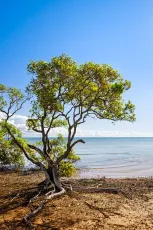
Little birdie with premium view
55361768635_cfe6140b70_k
行合橋 Yukiai Bridge
Yukiai Bridge ("Meeting Bridge") takes its name from a famous episode in the life of the Buddhist monk Nichiren (1222–1282). In 1271, Nichiren was arrested after openly criticizing other Buddhist sects and the policies of the Kamakura shogunate. He was taken to the execution grounds near present-day Ryukō-ji Temple. According to tradition, a brilliant light suddenly appeared in the sky just before the execution, and the sentence was called off. It is said that the messenger carrying the order to stop the execution met another messenger on his way to report Nichiren's death at this very spot. Because the two messengers "met" here, the bridge became known as Yukiai Bridge, literally "Meeting Bridge."
Aerial Sunrise Over the Sea
Winter Sunrise Seascape at Bilgola Beach on the Northern Beaches of Sydney, NSW, Australia.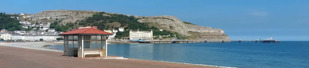
Llandudno
A panoramic view of Llandudno pier at over 700 metres long and the longest in Wales,the great orme headland with the grand hotel near the pier,taken during the June heatwave in 2026.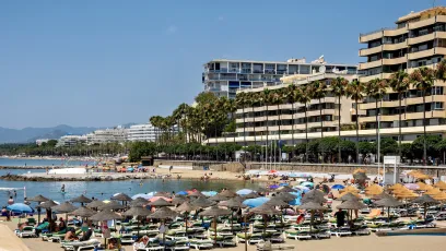
Marbella_03809
54611680569_324d36dd17_k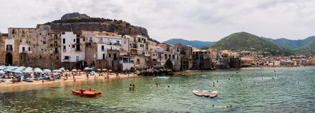
Cefalù | Spiaggia del Porto Vecchio Panorama
Panorama shot of Spiaggia del Porto Vecchio (Old Port Beach), Cefalù, Sicily.- <a href="https://live.staticflickr.com/65535/54924287772_c2d2fdbd2d_k.jpg" title="A lone sailboat gliding through soft light on calm, open water — captured in a high-key minimalistic style. The reduced palette and quiet atmosphere create a sense of stillness, letting the viewer drift into the moment.
Visit me on www.patrikseiler.com">
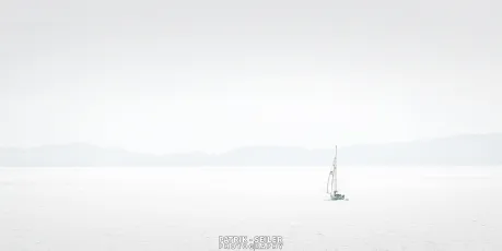
SAILING THROUGH SILENCE - Canada
A lone sailboat gliding through soft light on calm, open water — captured in a high-key minimalistic style. The reduced palette and quiet atmosphere create a sense of stillness, letting the viewer drift into the moment. Visit me on www.patrikseiler.com 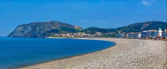
LLANDUDNO
Views of Llandudno, North Wales in June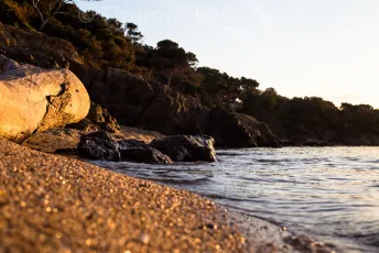
Calme
55318148614_4b78dd0129_b
IMG_4430
Costanera del Estrecho de Magallanes, Punta Arenas Región de Magallanes Chile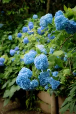
Hydrangeas in bloom 🌿💠
"Blue, here is a shell for you Inside you'll hear a sigh A foggy lullaby There is your song from me" At Meigetsuin in Kamakura, famous for its hydrangeas and often called the "Hydrangea Temple."- <a href="https://live.staticflickr.com/65535/24959845521_80ee96b589_b.jpg" title="Coloured pebbles at the foot of the cliff waterfall
www.johnshortlandwriter.com">
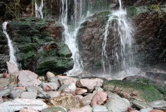
Woody Bay, Exmoor National Park
Coloured pebbles at the foot of the cliff waterfall www.johnshortlandwriter.com 
Dromana Beach
Beautiful calm and clear water, but it was the clouds that caught my eye.
Benalmádena_08027
53218881899_1dec222c87_k
Benalmádena_08069
53219007185_2c54e3e4c6_k
Berwick Beach
Rolleiflex 2.8f Rollei RPX25
Bateau Bay Beach Rocks
5587926199_dba8327687_b
seashore wanders
Bateau Bay
Winter Sunrise at the Seaside
Sunrise Seascape with waves at Avalon on the Northern Beaches of Sydney, NSW, Australia.
Sunrise at the Seaside with Cloud Covered Sky
Sunrise Seascape with cloud covered sky at Avalon on the Northern Beaches of Sydney, NSW, Australia.
Down by the water
Lots of great people watching at Golden Gardens Park on this beautiful weekend.
Golden Gardens Park in the spring
The last time I was here, it was cold and very, very empty. Instead, we found tons of people hanging out and enjoying the weekend sun.
The Eagle chugging off to Nantucket...
as Covid-19/Corona begins...
1953 Oldsmobile Fiesta Convertible Sunset Beach Cruise 1Dsii 24mm
SoCal Sunset Harbor Cruise 1953 Oldsmobile Fiesta If You Get The Chance, Visit Oceanside California, The Most Beautiful Laid Back Beach And One Of The Safest Cities In Southern California, Great Beaches Hotels, Boat Harbor, Longest Pier On The West Coast, Wonderful Surf And Sunsets, Great Restaurants, All In Walking Distance, And Friendly People.
Fonte da Telha - Almada
48723427591_c410a0dc27_b
Fonte da Telha - Almada
48723093398_70a22d1ee5_b
Fonte da Telha - Almada
48723600957_8e68999faf_b
Red Bluff, Sandringham/Black Rock
Somehow the Statue of Liberty poking out of the cliff and Charlton Heston slamming his fist into the ground saying "damn you all to hell!" wouldn't be out of place here. However a scene from Mad Max was filmed here.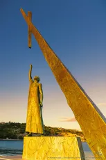
Pythagoras of Samos
This is a COLOUR photograph of Pythagoras’s bronze statue that is located on the waterfront of the town called Pythagoreion on Samos Island, Greece at sunset. The gigantic statue was created by the sculptor Nikolas IKARIS in New York and was unveiled in August 1989. On the statue’s base an inscription reads “the number 3 is the centre of the universe or the cosmos” (meaning: the number 3 is functionally significant for the universe). Pythagoras (c.580–496 B.C.) was a Greek philosopher, mathematician, and founder of the Pythagorean brotherhood and of the number theory; he was born in Samos. He formulated principles that influenced Plato’s and Aristotle’s thought and contributed to the development of mathematics and Western rational philosophy. He is credited with the discovery of the Pythagorean theorem for right triangles (the sum of the squares of the legs [a, b] of a right triangle is equal to the square on the hypotenuse [c]: a² + b² = c²).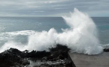
Waves
Water Sculptures from the power of the wind
Pointe du Hoc
55358231350_592b9a82df_k
peeking around the rocks
iPhone shot at Norah Head
Spoon Bay Rocks
Some Spoon Bay with my little Panasonic point & shoot.
Rafraîchissement
Canon EOS RP Canon EF 28/105mm 3.5-4.5 USM
“The coldest winter I ever spent was a summer in San Francisco.” - Mark Twain
What more needs to be said? Golden Gate National Recreation Area is on Coastal Miwok land.- <a href="https://live.staticflickr.com/65535/55357274505_53e89ab84b_c.jpg" title="Sardegna 2021
www.itineraricamper.it/italia/sardegna/giro-completo/">
Porto Palmas
Sardegna 2021 www.itineraricamper.it/italia/sardegna/giro-completo/ 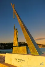
Pythagoras's Satue on Samos Isl. №3
This is a COLOUR photograph of Pythagoras's bronze statue that is located on the waterfront of the town called Pythagoreion on Samos Island, Greece at sunset. The gigantic statue was created by the sculptor Nikolas IKARIS in New York and was unveiled in August 1989. On the statue's base an inscription reads “the number 3 is the centre of the universe or the cosmos” (meaning: the number 3 is functionally significant for the universe). Pythagoras (c.580–496 B.C.) was a Greek philosopher, mathematician, and founder of the Pythagorean brotherhood and of the number theory; he was born in Samos. He formulated principles that influenced Plato's and Aristotle's thought and contributed to the development of mathematics and Western rational philosophy. He is credited with the discovery of the Pythagorean theorem for right triangles (the sum of the squares of the legs [a, b] of a right triangle is equal to the square on the hypotenuse [c]: a² + b² = c²).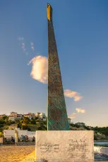
Pythagorass Satue on Samos Isl. №4
This is a COLOUR photograph of Pythagoras’s bronze statue at sunset from the South, showing the hypotenuse of the gigantic triangle; the statue is located on the waterfront of the town called Pythagoreion on Samos Island, Greece. The gigantic statue was created by the sculptor Nikolas IKARIS in New York and was unveiled in August 1989. There were lots of Greek expats’ organisations abroad which collected donations for the statue to be created and their names have all been carved on the statue’s marble base (enhancing techniques were applied to the marble inscriptions during post-processing in order to make them more legible). Pythagoras (c.580-496 B.C.) was a Greek philosopher, mathematician, and founder of the Pythagorean brotherhood and of the number theory; he was born in Samos. He formulated principles that influenced Plato’s and Aristotle’s thought and contributed to the development of mathematics and Western rational philosophy. He is credited with the discovery of the Pythagorean theorem for right triangles (the sum of the squares of the legs [a, b] of a right triangle is equal to the square on the hypotenuse [c]: a² + b² = c²).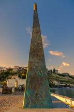
Pythagoras's Satue on Samos Isl. №5
This is a COLOUR photograph of Pythagoras's bronze statue at sunset from the South, showing the hypotenuse of the gigantic triangle; the statue is located on the waterfront of the town called Pythagoreion on Samos Island, Greece. The gigantic statue was created by the sculptor Nikolas IKARIS in New York and was unveiled in August 1989. Pythagoras (c.580–496 B.C.) was a Greek philosopher, mathematician, and founder of the Pythagorean brotherhood and of the number theory; he was born in Samos. He formulated principles that influenced Plato's and Aristotle's thought and contributed to the development of mathematics and Western rational philosophy. He is credited with the discovery of the Pythagorean theorem for right triangles (the sum of the squares of the legs [a, b] of a right triangle is equal to the square on the hypotenuse [c]: a² + b² = c²).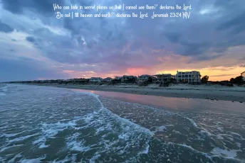
Isle of Palms, South Carolina
“Am I only a God nearby,” declares the Lord, “and not a God far away? Who can hide in secret places so that I cannot see them?” declares the Lord. “Do not I fill heaven and earth?” declares the Lord. [Jeremiah 23:23-24 NIV] 5 MORE THINGS YOU SHOULD KNOW: 1. Like it or not, we are ALL sinners: As the Scriptures say, “No one is righteous—not even one. No one is truly wise; no one is seeking God. All have turned away; all have become useless. No one does good, not a single one.” (Romans 3:10-12 NLT) 2. The punishment for sin is death: When Adam sinned, sin entered the world. Adam’s sin brought death, so death spread to everyone, for everyone sinned. (Romans 5:12 NLT) 3. Jesus is our only hope: But God showed his great love for us by sending Christ to die for us while we were still sinners. (Romans 5:8 NLT) For the wages of sin is death, but the free gift of God is eternal life through Christ Jesus our Lord. (Romans 6:23 NLT) 4. SALVATION is by GRACE through FAITH in JESUS: God saved you by his grace when you believed. And you can’t take credit for this; it is a gift from God. Salvation is not a reward for the good things we have done, so none of us can boast about it. For we are God’s masterpiece. He has created us anew in Christ Jesus, so we can do the good things he planned for us long ago. (Ephesians 2:8-10 NLT) 5. Accept Jesus and receive eternal life: If you openly declare that Jesus is Lord and believe in your heart that God raised him from the dead, you will be saved. (Romans 10:9 NLT) But to all who believed him and accepted him, he gave the right to become children of God. (John 1:12 NLT) And this is what God has testified: He has given us eternal life, and this life is in his Son. Whoever has the Son has life; whoever does not have God’s Son does not have life. (1 John 5:11-12 NLT) Read the Bible for yourself. Allow the Lord to speak to you through his Word. YOUR ETERNITY IS AT STAKE!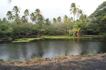
Tropical Lagoon
While exploring the Big Island, we came across a black beached lagoon. It was possibly one of the most incredible places I have ever seen. If it weren't for a whole island to explore, I would have loved to have just stayed in this very spot for our whole visit. However, I said that about many of the places we stumbled upon around the island. This place was magical, simply magical. This image was taken in JPG using only the settings on my camera; there was no post-processing or editing.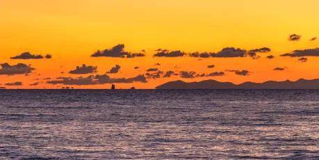
Freighter below the horizon
Twilight over Capraia Island, San Vincenzo, Tuscany, Mediterranean Sea, Italy Toskana-2_159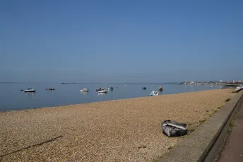
Flat calm on the top of the tide
The beach at Shoebury Common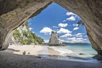
Cathedral Cove
The famous view through the sea cave at Cathedral Cove. The rock stack in the centre of the frame is known as Te Hoto.
Paradise
55356288733_7b9c04edee_h
DSCF0336
Teignmouth
La Palma Coast
near to the southern lighthouses. The ferocity of the waves was quite impressive. The rocks down there will become black sand in no time
Mak lampe - Mali Lošinj - Croatia
55356277140_0babad1aea_k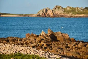
Le Diben, Plougasnou
55356047929_54ab9d7a3f_k
Sunrise Seascape with Calm Seas and a Cloud Covered Sky
Sunrise at Mona Vale Beach with a colourful cloudy sky and calm sea on the Northern Beaches of Sydney, NSW, Australia.
Diamond Beach
There's quite a steep hike to get here and not many people dare to do it!
RX408040
A view across Yellowcraigs Beach towards North Berwick and The Law.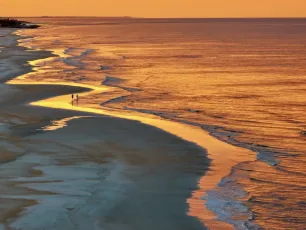
Molten Memories
As an Iowan I have spent an inordinate amount of my life on the beach. I have never had a night like tonight where the ocean turned a color like this. I am very colorblind but I assume this is red. I had my drone up for nearly two hours taking an endless amount of photos. This is just the first of many I am sure to post in the next couple of days. I was a big fan of the movie Total Recall. If Arnold Schwarzenegger goes back to Mars this will be one of his implanted memories.fault
RX408038
Yellowcraigs beach, on the Firth of Forth, near North Berwick, East Lothian, Scotland.
Lighthouse
55352153300_3ccbd4404e_b
Lighthouse (View B)
55352913535_b21140baaa_b
A Sky of Fire and Shadow
Late afternoon on Luskentyre Beach on the Isle of Harris, Outer Hebrides, Scotland
Aerial Sunrise Over the Sea
Winter Sunrise Seascape at Bilgola Beach on the Northern Beaches of Sydney, NSW, Australia.
Wellington - Breaker Bay
Another view of Breaker Bay and its interesting rock formations. If you look closely you can see a rock arch, but unfortunately you can't walk through it as it's fenced off.
Playa de Aguilar
Asturias
Fin
Shot with an iCatch V Series
Villers-sur-Mer
55354134191_bfd4749af6_k
Beautiful Ocean Mist @ Seaside Creek Beach - Mendocino County, CA
Not far from the town of Ft. Bragg, Pacific Coast of California....
Bamburgh Castle, Northumberland.
55354200988_b536a9c4f9_k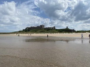
Bamburgh Castle, Northumberland.
55354045941_0670fa381b_k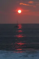
sailpath
5383448896_e4afe67ff3_k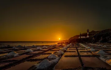
Salinas de Fuencaliente
55353661983_41e7855c09_b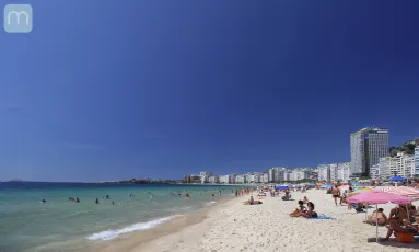
Praia de Copacabana no Rio de Janeiro
Copacabana - Rio de Janeiro - Brasil
That-is-it
55352600616_8caf35f651_k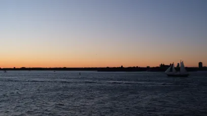
A Sunset and a Sailboat
Sailboat in the Upper New York Bay during golden hour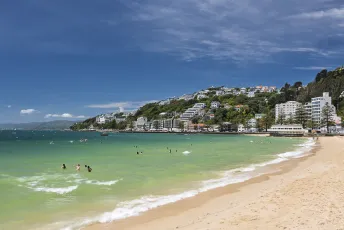
Wellington - Oriental Bay
One of the many urban beaches in Wellington
Villers-sur-Mer
55352316498_734ff08eac_k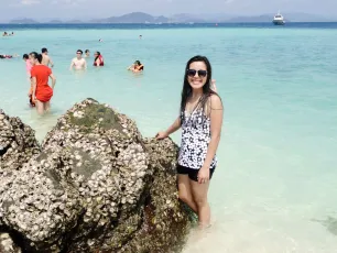
Turquoise Waters
Phi Phi Islands Tour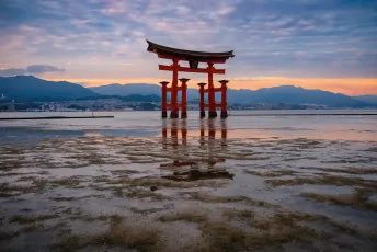
Itsukushima Shrine Otorii 厳島神社 大鳥居
55351946064_163972c1e4_k
Longest Day
Summerland, CA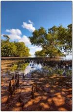
Mangrove trees
55351753618_ec040baf9c_k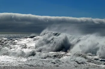
Waves
..at Los Quemados beach, La Palma. Beneath a bank of cloud. It was not a day for swimming
Alvito da Beira - Proença-a-Nova
28588429197_c960b503a4_b
Alvito da Beira - Proença-a-Nova
42570289165_0d0cd23537_b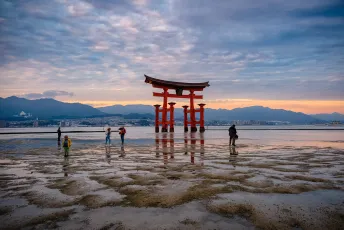
Itsukushima Shrine Otorii 厳島神社 大鳥居
The great torii (shrine gate) is the main subject against the gorgeous colors and the contrast between light & shadow during sunset. What’s also fascinating is that the patchy pattern in the sand and in the clouds are very similar, as if they are mirroring each other. Let me know if you think that’s interesting too. Thanks- <a href="https://live.staticflickr.com/65535/55351408894_c3ce5ba262_k.jpg" title="Saltburn beach, looking towards Hazel Grove and Marske
Saltburn by the sea, Yorkshire Coast, North Yorkshire, UK
©SWJuk (2026)
All rights reserved">
Z50_0899 - Saltburn Beach
Saltburn beach, looking towards Hazel Grove and Marske Saltburn by the sea, Yorkshire Coast, North Yorkshire, UK ©SWJuk (2026) All rights reserved 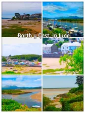
BORTH Y GEST
Collage Fun !!! Selection of photographs taken at the village of Borth y Gest, North Wales.
BORTH Y GEST
Walking around the village of Borth y Gest in June, Near Porthmadog, North Wales.
Castlepoint
View of the lighthouse from the foreshore in the town. Pohutakawa tree used for framing the scene.
Torre del Mar_01077
52077012352_62afb567d9_k
Valdarke Beach - Mali Lošinj - Croatia
55349847974_1d76091add_k
Newcastle - Newcastle Beach Lookout dolphins
55310951824_a204462964_k
Newcastle - Newcastle Beach
Right at the heart of the action, this is one of our most popular beaches. With cafes, beach kiosks, Newcastle Mall and hotels close by, it’s easy to understand why. Newcastle Beach has a reputation for being one of the best surf locations in Australia and is a favoured spot for board riders wishing to catch that perfect wave off Newcastle Point. Lifeguard Services are provided seven days a week during swimming season. A stroll between Newcastle Beach and Nobbys Beach will take approximately 15 minutes along the scenic Bather’s Way, with iconic Newcastle Ocean Baths in between.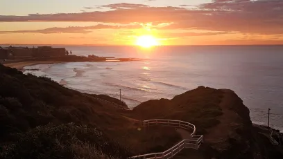
Newcastle - Brocks Bluff Lookout Sunrise
Located on Memorial Drive in The Hill (a short drive or walk up from Newcastle or Bar Beach), the lookout sits 61 meters above the ocean, making it a prime vantage point for whale watching.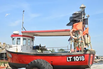
"Spring Tide"
Fishing boat on Aldeburgh beach, Suffolk, England.


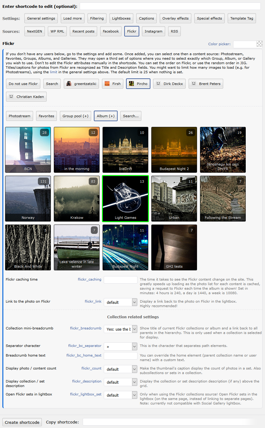
The above example uses the following, generated shortcode (how to use):[$justified_image_grid preset=13 lightbox=foobox mobile_lightbox=foobox max_rows=5 flickr_user=9585587@N08 flickr_group=1172962@N22]
What makes a Flickr Group pool useful?
It gives you the most control as group administrator by moderating photos and people. Work with 3rd party content, while having the appropriate control over all of which you'll eventually sync to WordPress.
- Load photos from public or invite-only groups (you or the added user must be a member). Private groups are not supported.
- If you are the group administrator, have full control over all content added to your Flickr Group pool.
- Display up to 500 of the latest photos from the desired pool.
- Learn more on the Flickr Groups FAQ page or at the new, shorter Yahoo help article about Flickr group administration.
How do the settings look like?
Flickr

Flickr